Area Overview for CH66 3PE
Photos of CH66 3PE


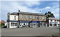

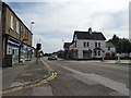


19 photos from this area
Area Information
Key information about the CH66 3PE including its size, population, and administrative classification.
- Area Type
- Postcode
- Area Size
- 3.8 hectares
- Population
- 1373
- Population Density
- 4185 people/km²
House Prices in CH66 3PE
29
Properties
£214,310
Average Sold Price
£95,000
Lowest Price
£378,500
Highest Price
Showing 29 properties
| Address | Type | Beds | Baths | Last Sale Price | Last Sale Date | |
|---|---|---|---|---|---|---|
| 57A Mill Lane, Great Sutton, Ellesmere Port, CH66 3PE | Bungalow | 2 | 1 | £230,000 | Feb 2024 | |
| 43 Mill Lane, Great Sutton, Ellesmere Port, CH66 3PE | house | - | - | £230,000 | May 2023 | |
| 27 Mill Lane, Great Sutton, Ellesmere Port, CH66 3PE | Bungalow | - | - | £250,000 | Oct 2022 | |
| The Croft Care Home, 59 Mill Lane, Great Sutton, Ellesmere Port, CH66 3PE | Retirement | - | - | £300,000 | Oct 2021 | |
| 33 Mill Lane, Great Sutton, Ellesmere Port, CH66 3PE | Semi-detached | 2 | 1 | £185,000 | Dec 2019 | |
| 51 Mill Lane, Great Sutton, Ellesmere Port, CH66 3PE | Bungalow | - | - | £221,000 | Nov 2019 | |
| 49A Mill Lane, Great Sutton, Ellesmere Port, CH66 3PE | Detached | 2 | 1 | £378,500 | Aug 2019 | |
| 21 Mill Lane, Great Sutton, Ellesmere Port, CH66 3PE | Detached | 3 | 3 | £347,000 | Aug 2019 | |
| 31 Mill Lane, Great Sutton, Ellesmere Port, CH66 3PE | Semi-detached | - | - | £170,000 | Oct 2018 | |
| 23 Mill Lane, Great Sutton, Ellesmere Port, CH66 3PE | Semi-detached | 3 | 1 | £203,000 | Jun 2017 |
Page 1 of 3
Energy Efficiency in CH66 3PE
Amenities
Schools
| Rank | School | Type | Entry gender | Ages |
|---|
Explore more schools in this area
Go to Schools tabDemographics
Household Size
Two person
most common
Accommodation Type
Houses
most common
Tenure
73
majority
Ethnic Group
White
most common
Religion
N/A
most common
Household Composition
N/A
most common
Age
47
median
Adults (30-64 years)
most common
Household Deprivation
N/A
with no deprivation
NS-SEC
25
in Lower managerial occupations
Explore more demographic insights in this area
Go to Demographics tabPlanning
Planning Constraints
- Flood RiskPremium
- Ramsar Wetland SitesPremium
- Area of Outstanding Natural BeautyPremium
- Protected Nature ReservePremium
- Protected WoodlandPremium