Area Overview for CH66 2HN
Photos of CH66 2HN

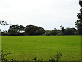

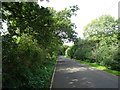


7 photos from this area
Area Information
Key information about the CH66 2HN including its size, population, and administrative classification.
- Area Type
- Postcode
- Area Size
- 11.6 hectares
- Population
- 2771
- Population Density
- 114 people/km²
House Prices in CH66 2HN
36
Properties
£186,112
Average Sold Price
£66,500
Lowest Price
£412,500
Highest Price
Showing 36 properties
| Address | Type | Beds | Baths | Last Sale Price | Last Sale Date | |
|---|---|---|---|---|---|---|
| 29 Beechwood Drive, Great Sutton, Ellesmere Port, CH66 2HN | Detached | 5 | 2 | £412,500 | Aug 2025 | |
| 17 Beechwood Drive, Great Sutton, Ellesmere Port, CH66 2HN | house | 4 | 2 | £340,000 | Mar 2025 | |
| 10 Beechwood Drive, Great Sutton, Ellesmere Port, CH66 2HN | Detached | 3 | 1 | £215,000 | Dec 2020 | |
| 19 Beechwood Drive, Great Sutton, Ellesmere Port, CH66 2HN | Detached | 3 | 2 | £225,000 | Oct 2019 | |
| 1 Beechwood Drive, Great Sutton, Ellesmere Port, CH66 2HN | Detached | 4 | 2 | £260,000 | Apr 2019 | |
| 21 Beechwood Drive, Great Sutton, Ellesmere Port, CH66 2HN | Detached | 3 | 2 | £186,000 | Mar 2019 | |
| 11 Beechwood Drive, Great Sutton, Ellesmere Port, CH66 2HN | Detached | 3 | 1 | £203,000 | Oct 2018 | |
| 49 Beechwood Drive, Great Sutton, Ellesmere Port, CH66 2HN | Detached | 3 | 2 | £225,000 | Aug 2018 | |
| 33 Beechwood Drive, Great Sutton, Ellesmere Port, CH66 2HN | house | - | - | £232,000 | Nov 2017 | |
| 18 Beechwood Drive, Great Sutton, Ellesmere Port, CH66 2HN | Detached | 4 | 2 | £212,500 | Mar 2016 |
Page 1 of 4
Energy Efficiency in CH66 2HN
Amenities
Schools
| Rank | School | Type | Entry gender | Ages |
|---|
Explore more schools in this area
Go to Schools tabDemographics
Household Size
Two person
most common
Accommodation Type
Houses
most common
Tenure
76
majority
Ethnic Group
White
most common
Religion
N/A
most common
Household Composition
N/A
most common
Age
47
median
Adults (30-64 years)
most common
Household Deprivation
N/A
with no deprivation
NS-SEC
40
in Lower managerial occupations
Explore more demographic insights in this area
Go to Demographics tabPlanning
Planning Constraints
- Flood RiskPremium
- Ramsar Wetland SitesPremium
- Area of Outstanding Natural BeautyPremium
- Protected Nature ReservePremium
- Protected WoodlandPremium