Area Overview for CH65 9BE
Photos of CH65 9BE


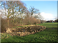

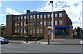


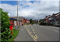

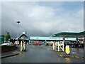
30 photos from this area
Area Information
Key information about the CH65 9BE including its size, population, and administrative classification.
- Area Type
- Postcode
- Area Size
- 1.2 hectares
- Population
- Not available
- Population Density
- Not available
House Prices in CH65 9BE
11
Properties
£107,000
Average Sold Price
£107,000
Lowest Price
£107,000
Highest Price
Showing 11 properties
| Address | Type | Beds | Baths | Last Sale Price | Last Sale Date | |
|---|---|---|---|---|---|---|
| 75 Chester Road, Whitby, Ellesmere Port, CH65 9BE | Detached | - | - | £107,000 | May 2001 | |
| Flat, 37 Chester Road, Whitby, Ellesmere Port, CH65 9BE | Flat | - | - | - | - | |
| 17A Chester Road, Whitby, Ellesmere Port, CH65 9BE | Flat | 1 | 1 | - | - | |
| 25A Chester Road, Whitby, Ellesmere Port, CH65 9BE | Flat | - | - | - | - | |
| 73 Chester Road, Whitby, Ellesmere Port, CH65 9BE | Detached | - | - | - | - | |
| 19A Chester Road, Whitby, Ellesmere Port, CH65 9BE | Flat | - | - | - | - | |
| 35 Chester Road, Whitby, Ellesmere Port, CH65 9BE | Flat | - | - | - | - | |
| Global Renewable Solutions Ltd, 23 Chester Road, Whitby, Ellesmere Port, CH65 9BE | Office | - | - | - | - | |
| Pernickety, 49 Chester Road, Whitby, Ellesmere Port, CH65 9BE | retail_financial | - | - | - | - | |
| Chester District Blind Fed, 65A Chester Road, Whitby, Ellesmere Port, CH65 9BE | office_workshop | - | - | - | - |
Page 1 of 2
Energy Efficiency in CH65 9BE
Amenities
Schools
| Rank | School | Type | Entry gender | Ages |
|---|
Explore more schools in this area
Go to Schools tabDemographics
Household Size
Two person
most common
Accommodation Type
Houses
most common
Tenure
87
majority
Ethnic Group
White
most common
Religion
N/A
most common
Household Composition
N/A
most common
Age
47
median
Adults (30-64 years)
most common
Household Deprivation
N/A
with no deprivation
NS-SEC
35
in Lower managerial occupations
Explore more demographic insights in this area
Go to Demographics tabPlanning
Planning Constraints
- Flood RiskPremium
- Ramsar Wetland SitesPremium
- Area of Outstanding Natural BeautyPremium
- Protected Nature ReservePremium
- Protected WoodlandPremium