Area Overview for CH65 4FL
Photos of CH65 4FL

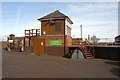
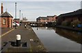


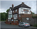
100 photos from this area
Area Information
Key information about the CH65 4FL including its size, population, and administrative classification.
- Area Type
- Postcode
- Area Size
- 7672 m²
- Population
- 1246
- Population Density
- 280 people/km²
House Prices in CH65 4FL
43
Properties
£108,981
Average Sold Price
£43,000
Lowest Price
£165,000
Highest Price
Showing 43 properties
| Address | Type | Beds | Baths | Last Sale Price | Last Sale Date | |
|---|---|---|---|---|---|---|
| 5, Telfords Quay, South Pier Road, Ellesmere Port, CH65 4FL | Flat | 2 | 1 | £135,000 | Jun 2024 | |
| 40, Telfords Quay, South Pier Road, Ellesmere Port, CH65 4FL | Flat | - | - | £119,500 | Feb 2024 | |
| 30, Telfords Quay, South Pier Road, Ellesmere Port, CH65 4FL | Flat | - | - | £110,000 | Nov 2023 | |
| 28, Telfords Quay, South Pier Road, Ellesmere Port, CH65 4FL | Flat | - | - | £130,000 | Nov 2023 | |
| 41, Telfords Quay, South Pier Road, Ellesmere Port, CH65 4FL | Flat | 2 | 1 | £105,000 | Mar 2023 | |
| 39, Telfords Quay, South Pier Road, Ellesmere Port, CH65 4FL | Flat | - | - | £138,500 | Mar 2023 | |
| 15, Telfords Quay, South Pier Road, Ellesmere Port, CH65 4FL | Flat | - | - | £103,000 | Jun 2022 | |
| 25, Telfords Quay, South Pier Road, Ellesmere Port, CH65 4FL | Flat | 2 | 1 | £120,000 | Mar 2022 | |
| 29, Telfords Quay, South Pier Road, Ellesmere Port, CH65 4FL | Flat | - | - | £120,000 | Dec 2021 | |
| 23, Telfords Quay, South Pier Road, Ellesmere Port, CH65 4FL | Flat | - | - | £98,000 | Sep 2021 |
Page 1 of 5
Energy Efficiency in CH65 4FL
Amenities
Schools
| Rank | School | Type | Entry gender | Ages |
|---|
Explore more schools in this area
Go to Schools tabDemographics
Household Size
One person
most common
Accommodation Type
Houses
most common
Tenure
36
majority
Ethnic Group
White
most common
Religion
N/A
most common
Household Composition
N/A
most common
Age
47
median
Adults (30-64 years)
most common
Household Deprivation
N/A
with no deprivation
NS-SEC
21
in Lower managerial occupations
Explore more demographic insights in this area
Go to Demographics tabPlanning
Planning Constraints
- Flood RiskPremium
- Ramsar Wetland SitesPremium
- Area of Outstanding Natural BeautyPremium
- Protected Nature ReservePremium
- Protected WoodlandPremium