Area Overview for CH65 4AU
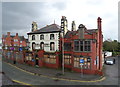
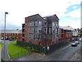
Photos of CH65 4AU


Area Information
Living in CH65 4AU offers a compact, residential experience within the broader context of Ellesmere Port, Cheshire. The area covers 2,237 square metres and is home to 1,246 people, translating to a population density of 280 people per square kilometre. This small postcode cluster is part of the Westminster Ward, a defined electoral area with a population of around 1,332. The community is centred on modest housing, with a median age of 47, suggesting a mature demographic. Daily life here is likely shaped by proximity to nearby amenities, including five rail stations such as Ellesmere Port and Overpool, which provide direct links to broader regional networks. The area’s small size means it is tightly integrated with surrounding towns, offering a balance of local convenience and regional accessibility. While the population is relatively low, the density supports a sense of community, with residents likely relying on nearby shops, transport hubs, and the two nearby airports for travel. The area’s compact nature makes it a practical choice for those prioritising ease of access to services and connectivity.
- Area Type
- Postcode
- Area Size
- 2237 m²
- Population
- 1246
- Population Density
- 280 people/km²
The property market in CH65 4AU is defined by a 36% home ownership rate, indicating that the majority of housing stock is likely rented. The area is predominantly composed of houses, which may reflect a preference for single-family dwellings over flats or apartments. This suggests a market where rental properties dominate, potentially catering to families or professionals seeking long-term tenancies. The small size of the area—just 2,237 square metres—means the housing stock is limited, with little scope for expansion or new developments. Buyers considering the area should note that property availability may be constrained, and the market may be more competitive for owner-occupied homes. The focus on houses also implies that properties are likely to be larger than average for the region, which could influence pricing and demand. For those seeking investment opportunities, the low home ownership rate and compact footprint suggest a niche market requiring careful consideration of local needs and trends.
House Prices in CH65 4AU
No properties found in this postcode.
Energy Efficiency in CH65 4AU
Daily life in CH65 4AU is supported by a range of nearby amenities, including five retail outlets such as Morrisons Daily, Aldi Ellesmere, and Farmfoods Ellesmere. These shops provide essential grocery and household supplies, reducing the need for long trips to larger centres. The area’s rail network, with five stations including Ellesmere Port, offers easy access to broader regional services, from commuting to leisure activities. While the data does not mention parks or recreational facilities, the proximity to rail stations suggests that residents can quickly reach green spaces or cultural hubs in nearby towns. The presence of two airports nearby adds to the area’s appeal for frequent travellers. Overall, the combination of local retail, reliable transport, and regional connectivity ensures a convenient lifestyle, balancing everyday needs with the flexibility to explore beyond the immediate postcode.
Amenities
Schools
| Rank | School | Type | Entry gender | Ages |
|---|
Explore more schools in this area
Go to Schools tabDemographics
The demographic profile of CH65 4AU reflects a community predominantly composed of adults aged 30–64, with a median age of 47. This suggests a settled population, likely including families and professionals in midlife. Home ownership rates are relatively low at 36%, indicating that a significant proportion of residents are likely to rent their properties. The area is characterised by houses rather than flats or apartments, which may appeal to those seeking more space or traditional housing. The predominant ethnic group is White, with no specific data provided on other ethnicities. The population density of 280 people per square kilometre implies a mix of single-family homes and possibly multi-generational households. While the data does not explicitly mention deprivation levels, the low home ownership rate and moderate population size suggest a community that may prioritise rental affordability over property investment. This dynamic could influence local services and amenities, tailored to meet the needs of a stable, middle-aged population.
Household Size
Accommodation Type
Tenure
Ethnic Group
Religion
Household Composition
Age
Household Deprivation
NS-SEC
Explore more demographic insights in this area
Go to Demographics tabPlanning
Planning Constraints
- Flood RiskPremium
- Ramsar Wetland SitesPremium
- Area of Outstanding Natural BeautyPremium
- Protected Nature ReservePremium
- Protected WoodlandPremium