Area Overview for CH65 2DL
Photos of CH65 2DL

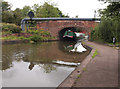
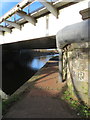
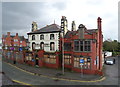
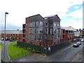
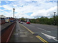
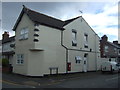

80 photos from this area
Area Information
Key information about the CH65 2DL including its size, population, and administrative classification.
- Area Type
- Postcode
- Area Size
- 1.2 hectares
- Population
- 1234
- Population Density
- 102632 people/km²
House Prices in CH65 2DL
41
Properties
£79,556
Average Sold Price
£55,500
Lowest Price
£112,500
Highest Price
Showing 41 properties
| Address | Type | Beds | Baths | Last Sale Price | Last Sale Date | |
|---|---|---|---|---|---|---|
| 48 John Nicholas Crescent, Ellesmere Port, CH65 2DL | Flat | 2 | 1 | £70,000 | Jun 2025 | |
| 46 John Nicholas Crescent, Ellesmere Port, CH65 2DL | Flat | - | - | £62,500 | Nov 2023 | |
| 18 John Nicholas Crescent, Ellesmere Port, CH65 2DL | Terraced | 3 | 1 | £112,500 | May 2023 | |
| 10 John Nicholas Crescent, Ellesmere Port, CH65 2DL | Flat | - | - | £65,000 | Dec 2021 | |
| 36 John Nicholas Crescent, Ellesmere Port, CH65 2DL | Flat | - | - | £55,500 | Feb 2019 | |
| 38 John Nicholas Crescent, Ellesmere Port, CH65 2DL | Flat | - | - | £69,950 | Jul 2007 | |
| 16 John Nicholas Crescent, Ellesmere Port, CH65 2DL | Terraced | - | - | £95,000 | Jun 2007 | |
| 20 John Nicholas Crescent, Ellesmere Port, CH65 2DL | Terraced | - | - | £106,000 | Jul 2006 | |
| Flat 3, 1 John Nicholas Crescent, Ellesmere Port, CH65 2DL | Flat | - | - | - | - | |
| Flat 2, 1 John Nicholas Crescent, Ellesmere Port, CH65 2DL | Flat | - | - | - | - |
Page 1 of 5
Energy Efficiency in CH65 2DL
Amenities
Schools
| Rank | School | Type | Entry gender | Ages |
|---|
Explore more schools in this area
Go to Schools tabDemographics
Household Size
One person
most common
Accommodation Type
Flats
most common
Tenure
13
majority
Ethnic Group
White
most common
Religion
N/A
most common
Household Composition
N/A
most common
Age
47
median
Adults (30-64 years)
most common
Household Deprivation
N/A
with no deprivation
NS-SEC
12
in Lower managerial occupations
Explore more demographic insights in this area
Go to Demographics tabPlanning
Planning Constraints
- Flood RiskPremium
- Ramsar Wetland SitesPremium
- Area of Outstanding Natural BeautyPremium
- Protected Nature ReservePremium
- Protected WoodlandPremium