Area Overview for CH65 1AL
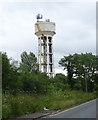
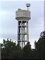
Photos of CH65 1AL


Area Information
Living in CH65 1AL means being part of a small, tightly knit residential cluster in the heart of Cheshire West and Chester. This postcode covers 87.2 hectares and is home to 1,246 residents, giving it a population density of 280 people per square kilometre. Situated near Ellesmere Port, the area is defined by its compact size and proximity to key regional hubs. The community is predominantly composed of adults aged 30–64, with a median age of 47, suggesting a mature, stable demographic. Daily life here is shaped by the balance between residential tranquillity and access to nearby amenities. While the area does not boast sprawling landscapes or major urban centres, its strategic location ensures residents can reach rail networks, retail outlets, and airports within short distances. The absence of protected natural sites or planning constraints means development is not restricted, offering a practical, no-frills environment for those prioritising convenience over rural charm. For buyers seeking a low-maintenance, functional living space with straightforward access to transport, CH65 1AL presents a straightforward proposition.
- Area Type
- Postcode
- Area Size
- 87.2 hectares
- Population
- 1246
- Population Density
- 280 people/km²
The property market in CH65 1AL is shaped by its small size and limited housing stock. With 36% of households being owner-occupied, the area is not dominated by long-term residents but rather by a mix of renters and homeowners. The accommodation type is primarily houses, which is unusual for a postcode of this scale, suggesting a focus on single-family dwellings rather than flats or apartments. This dynamic implies that the housing stock is relatively uniform, with limited variation in property types. For buyers, this presents a challenge: the area’s small footprint means there are few properties available, and competition may be fierce. The prevalence of houses also means that the market is likely geared towards families or individuals seeking standalone homes rather than investment opportunities in rental properties. Proximity to rail stations and airports may make the area appealing to commuters or those prioritising transport links over expansive gardens or larger homes. However, the lack of protected sites or planning constraints means there is no premium attached to the area’s environmental features, keeping property values grounded.
House Prices in CH65 1AL
No properties found in this postcode.
Energy Efficiency in CH65 1AL
The lifestyle in CH65 1AL is defined by its proximity to essential amenities within walking or short driving distance. Retail options include major chains such as Tesco Rossmore Rd, Co-op Overpool, and Morrisons Daily Ellesmere, ensuring residents have access to everyday shopping needs. The area’s rail stations—Overpool, Little Sutton, and Ellesmere Port—provide direct links to nearby towns and cities, making it easy to access cultural, professional, or leisure opportunities beyond the immediate postcode. While the area does not feature large parks or recreational spaces, its compact size means amenities are concentrated, reducing the need for long commutes. The presence of two airports nearby also opens up travel possibilities, whether for business or leisure. For those who prioritise convenience over expansive green spaces, CH65 1AL offers a functional lifestyle with minimal effort. The character of the area is modest but practical, with a focus on accessibility and straightforward living.
Amenities
Schools
| Rank | School | Type | Entry gender | Ages |
|---|
Explore more schools in this area
Go to Schools tabDemographics
The community in CH65 1AL is characterised by a median age of 47, with the majority of residents falling within the 30–64 age range. This suggests a population skewed towards middle-aged individuals, likely including families and professionals in their prime working years. Home ownership here is relatively low, with only 36% of households owning their properties, indicating a higher reliance on rental accommodation. The accommodation type is predominantly houses, which aligns with the area’s residential focus and smaller scale. The predominant ethnic group is White, reflecting the broader demographic trends in the region. While specific data on diversity is not provided, the absence of notable ethnic minority representation is evident. The population density of 280 people per square kilometre means the area is neither densely packed nor sparsely populated, offering a moderate balance between privacy and community interaction. This demographic profile suggests a stable, mature population with established routines, though the lower home ownership rate may imply a transient or rental-driven housing market.
Household Size
Accommodation Type
Tenure
Ethnic Group
Religion
Household Composition
Age
Household Deprivation
NS-SEC
Explore more demographic insights in this area
Go to Demographics tabPlanning
Planning Constraints
- Flood RiskPremium
- Ramsar Wetland SitesPremium
- Area of Outstanding Natural BeautyPremium
- Protected Nature ReservePremium
- Protected WoodlandPremium