Area Overview for CH65 0BG
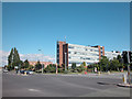
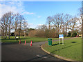
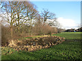
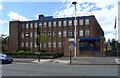
Photos of CH65 0BG


Area Information
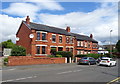
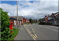
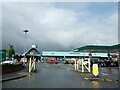
Living in CH65 0BG means inhabiting a tightly packed residential cluster in England’s Cheshire West and Chester area. This postcode covers just 1.9 hectares, yet it is home to 1,371 people, making it one of the most densely populated areas in the country at 72,286 people per square kilometre. The community is characterised by its compactness, with houses forming the predominant accommodation type. Daily life here is shaped by proximity to key services and transport links. Residents benefit from being near Ellesmere Port Railway Station and other nearby stations, which connect to broader regional networks. The area’s high broadband score of 100 ensures seamless digital connectivity, supporting both work and leisure. While the population skews toward adults aged 30–64, the presence of shops like Asda Ellesmere and nearby airports suggests a balance between local convenience and access to wider opportunities. CH65 0BG is a microcosm of a small town’s rhythm, where proximity to amenities and transport hubs defines the lived experience.
- Area Type
- Postcode
- Area Size
- 1.9 hectares
- Population
- 1371
- Population Density
- 4535 people/km²
The property market in CH65 0BG is defined by its small size and high density. With 42% of homes owned by residents, the area is not dominated by rentals, though the figure suggests a significant proportion of properties are let. The accommodation type is primarily houses, which is unusual for a densely populated area, indicating a mix of single-family homes and possibly terraced housing. Given the postcode’s limited area, the housing stock is constrained, making it a niche market for buyers seeking compact living. Proximity to rail stations and airports may attract commuters or those prioritising transport links. However, the lack of large-scale development means property options are limited, and buyers should consider the area’s small footprint when evaluating long-term suitability.
House Prices in CH65 0BG
No properties found in this postcode.
Energy Efficiency in CH65 0BG
Life in CH65 0BG is shaped by its proximity to essential amenities. Residents have access to five retail outlets, including Asda Ellesmere, Iceland Ellesmere, and Farmfoods Ellesmere, providing everyday shopping convenience. The area’s rail network, with stations like Ellesmere Port and Overpool, connects to broader transport systems, while nearby airports offer easy travel options. Though the postcode is small, its location near larger towns ensures access to more extensive leisure and dining options. The absence of major parks or green spaces within the area itself means residents may need to travel to nearby towns for recreational activities. However, the density of services and transport links compensates for this, creating a lifestyle that prioritises accessibility over expansive natural environments.
Amenities
Schools
| Rank | School | Type | Entry gender | Ages |
|---|
Explore more schools in this area
Go to Schools tabDemographics
CH65 0BG has a median age of 47, with the majority of residents aged 30–64. This suggests a community of established professionals and families, rather than students or retirees. Home ownership stands at 42%, meaning nearly half of properties are rented, reflecting a mix of owner-occupied and rental housing. The area is predominantly White, with no specific data on other ethnic groups provided. The high population density—72,286 people per square kilometre—indicates a compact, closely knit community. While this density may foster social interaction, it also implies limited green space per household. The age profile suggests a stable, mature demographic, potentially influencing local services and amenities. However, the lack of data on deprivation or income levels means the full picture of quality of life remains partially obscured.
Household Size
Accommodation Type
Tenure
Ethnic Group
Religion
Household Composition
Age
Household Deprivation
NS-SEC
Explore more demographic insights in this area
Go to Demographics tabPlanning
Planning Constraints
- Flood RiskPremium
- Ramsar Wetland SitesPremium
- Area of Outstanding Natural BeautyPremium
- Protected Nature ReservePremium
- Protected WoodlandPremium