Area Overview for CH64 6QU
Photos of CH64 6QU
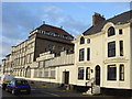
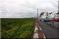
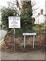
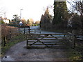
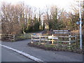
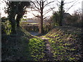
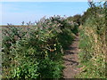
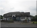
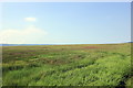
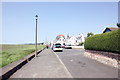
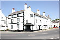
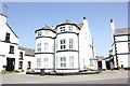
81 photos from this area
Area Information
Key information about the CH64 6QU including its size, population, and administrative classification.
- Area Type
- Postcode
- Area Size
- 1.4 hectares
- Population
- 2046
- Population Density
- 202 people/km²
House Prices in CH64 6QU
13
Properties
£378,000
Average Sold Price
£114,000
Lowest Price
£660,000
Highest Price
Showing 13 properties
| Address | Type | Beds | Baths | Last Sale Price | Last Sale Date | |
|---|---|---|---|---|---|---|
| The Mews, Wood Lane, Parkgate, Neston, CH64 6QU | house | 3 | 1 | £370,000 | Mar 2025 | |
| Elm Court, Wood Lane, Parkgate, Neston, CH64 6QU | house | - | - | £635,000 | Sep 2021 | |
| The Coach House, Wood Lane, Parkgate, Neston, CH64 6QU | house | - | - | £625,000 | Aug 2020 | |
| Jalna Cottage, Wood Lane, Parkgate, Neston, CH64 6QU | Bungalow | 2 | - | £357,000 | Jul 2017 | |
| Orchard House, Wood Lane, Parkgate, Neston, CH64 6QU | Detached | 4 | - | £660,000 | Sep 2012 | |
| Kelowna, Wood Lane, Parkgate, Neston, CH64 6QU | Detached | 4 | - | £650,000 | Nov 2009 | |
| The Old Orchard, Wood Lane, Parkgate, Neston, CH64 6QU | Detached | 4 | 2 | £212,000 | Jun 2002 | |
| Green Rigg, Wood Lane, Parkgate, Neston, CH64 6QU | Detached | - | - | £225,000 | Sep 1999 | |
| Clare Cottage, Wood Lane, Parkgate, Neston, CH64 6QU | Detached | - | - | £135,000 | Jul 1999 | |
| The Shieling, Wood Lane, Parkgate, Neston, CH64 6QU | Detached | - | - | £114,000 | Aug 1997 |
Page 1 of 2
Energy Efficiency in CH64 6QU
Amenities
Schools
| Rank | School | Type | Entry gender | Ages |
|---|
Explore more schools in this area
Go to Schools tabDemographics
Household Size
Two person
most common
Accommodation Type
Houses
most common
Tenure
87
majority
Ethnic Group
White
most common
Religion
N/A
most common
Household Composition
N/A
most common
Age
47
median
Elderly (65+ years)
most common
Household Deprivation
N/A
with no deprivation
NS-SEC
52
in Lower managerial occupations
Explore more demographic insights in this area
Go to Demographics tabPlanning
Planning Constraints
- Flood RiskPremium
- Ramsar Wetland SitesPremium
- Area of Outstanding Natural BeautyPremium
- Protected Nature ReservePremium
- Protected WoodlandPremium