Area Overview for CH64 4HL
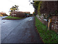
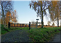
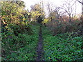
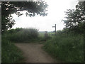
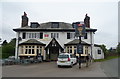
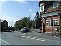
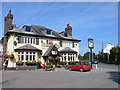
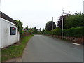
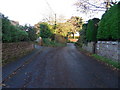
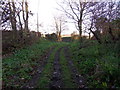
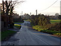
Photos of CH64 4HL

Area Information
Living in CH64 4HL means inhabiting a small, tightly knit residential cluster in the heart of Neston, a historic market town in Cheshire. With a population of 1,563 spread over a low-density area, the postcode reflects a quiet, community-focused lifestyle. Neston’s character is steeped in history, from Viking-era settlements to its role as a thriving port in the 16th century. Today, the area retains its tranquil countryside charm while offering modern conveniences. The proximity to amenities like Tesco Neston and nearby railway stations ensures practicality for daily life, balancing heritage with accessibility. Residents benefit from a low crime risk and minimal environmental constraints, making it a stable place to live. The area’s compact size fosters a close-knit community, where the Friday market and monthly Farmer’s Market continue to echo Neston’s historical roots. For buyers, CH64 4HL represents a blend of tradition and tranquility, ideal for those seeking a peaceful yet connected lifestyle in a town with rich cultural layers.
- Area Type
- Postcode
- Area Size
- Not available
- Population
- 1563
- Population Density
- 97 people/km²
The property market in CH64 4HL is overwhelmingly owner-occupied, with 91% of homes owned by residents rather than rented. This high rate of home ownership suggests a stable, long-term demographic, with fewer short-term renters or speculative investments. The accommodation type is predominantly houses, which aligns with the area’s low population density and rural character. Given the small size of the postcode and its focus on residential clusters, the housing stock is likely limited in variety, with properties reflecting traditional or semi-detached designs. For buyers, this means a market where properties are likely to be in private hands, with fewer opportunities for rental income. The compact nature of the area also means that the immediate surroundings—such as nearby Neston—offer additional options, though the data does not specify their availability. Buyers should consider the area’s historical appeal and low environmental risks as key selling points, while recognising the limited scale of the local market.
House Prices in CH64 4HL
No properties found in this postcode.
Energy Efficiency in CH64 4HL
Residents of CH64 4HL have access to a range of nearby amenities, including five retail outlets such as Tesco Neston, Sainsburys Neston, and Aldi Neston, ensuring convenience for grocery shopping and daily errands. The presence of five railway stations, including Neston Railway Station, enhances mobility, linking the area to broader transport networks. While the data does not specify parks or leisure facilities, Neston’s historic market town character suggests cultural and historical attractions, such as the Parish Church of St Mary and St Helen, are within reach. The Friday market and monthly Farmer’s Market add to the area’s charm, offering local produce and community engagement. The combination of practical retail options, rail connectivity, and historical landmarks contributes to a lifestyle that balances modern convenience with traditional appeal.
Amenities
Schools
The nearest school to CH64 4HL is Bishop Wilson Church of England Primary School, a primary institution with an Ofsted rating of ‘good’. This school serves the local community, providing education for younger children within practical reach of residents. The absence of secondary schools or other educational institutions in the immediate vicinity means families may need to look further afield for comprehensive schooling. However, the presence of a well-rated primary school is a significant advantage for parents prioritising early education. The school’s ‘good’ rating indicates a satisfactory standard of teaching and facilities, though it does not provide detailed information on curriculum or extracurricular offerings. For families, this school is a key consideration, but it also highlights the need to plan for secondary education options outside the postcode.
| Rank | School | Type | Entry gender | Ages |
|---|
Explore more schools in this area
Go to Schools tabDemographics
The community in CH64 4HL is predominantly composed of adults aged 30–64, with a median age of 47. This suggests a mature, established population, likely drawn to the area’s stability and historical significance. Home ownership is exceptionally high at 91%, indicating a strong sense of local investment and long-term residency. The accommodation type is primarily houses, reflecting a preference for larger, more private living spaces. The predominant ethnic group is White, aligning with broader demographic trends in the region. The low population density of 97 people per km² reinforces the area’s rural, spacious character. While no specific deprivation data is provided, the high home ownership and low crime risk suggest a relatively affluent and secure environment. This profile paints a picture of a community that values stability, heritage, and a slower pace of life, with residents likely prioritising family-oriented living over urban dynamism.
Household Size
Accommodation Type
Tenure
Ethnic Group
Religion
Household Composition
Age
Household Deprivation
NS-SEC
Explore more demographic insights in this area
Go to Demographics tabPlanning
Planning Constraints
- Flood RiskPremium
- Ramsar Wetland SitesPremium
- Area of Outstanding Natural BeautyPremium
- Protected Nature ReservePremium
- Protected WoodlandPremium