Area Overview for CH64 4BB
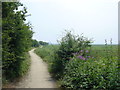
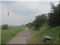
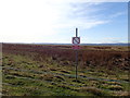
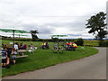
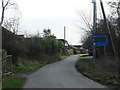
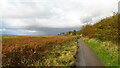
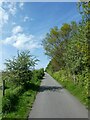
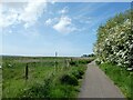
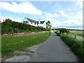
Photos of CH64 4BB
Area Information
Living in CH64 4BB means being part of a small, tightly knit residential cluster in the heart of Neston, a historic market town in Cheshire. The area covers 14.8 hectares, with 1,563 residents spread across a population density of 97 people per square kilometre. Neston itself, with a population of around 2,480, retains its tranquil character despite its proximity to the Wirral Peninsula. The town’s name derives from Old Norse, reflecting its ancient roots as a settlement near a promontory that once jutted into the Dee Estuary. Today, CH64 4BB benefits from Neston’s historic charm, including its 14th-century Parish Church of St Mary and St Helen and a thriving Friday market. The area’s small size and low population density create a quiet, community-focused environment, where residents are likely to know their neighbours. With a median age of 47 and a population skewed toward adults aged 30–64, the area feels settled and stable, with a strong emphasis on home ownership.
- Area Type
- Postcode
- Area Size
- 14.8 hectares
- Population
- 1563
- Population Density
- 97 people/km²
The property market in CH64 4BB is characterised by high home ownership (91%) and a focus on houses rather than flats, reflecting a demographic of established residents prioritising stability and space. As a small, residential postcode area, the housing stock is limited, with homes likely to be older properties that have retained their value over time. The high proportion of owner-occupied homes suggests a community where long-term investment is common, and property turnover is relatively low. Buyers considering the area should note the proximity to Neston’s amenities, including its historic market and rail links, which may enhance property appeal. However, the limited size of CH64 4BB means competition for available homes could be fierce, particularly for those seeking properties with specific features. The absence of rental properties in the data implies that the area is not a hotspot for short-term lets or student housing, further reinforcing its appeal to settled, family-oriented buyers.
House Prices in CH64 4BB
Showing 8 properties
| Address | Type | Beds | Baths | Last Sale Price | Last Sale Date | |
|---|---|---|---|---|---|---|
| 4 Snab Lane, Ness, Neston, CH64 4BB | house | - | - | £250,000 | Feb 2017 | |
| Dingle Cottage, 2 Snab Lane, Ness, Neston, CH64 4BB | Detached | - | - | £95,000 | Jan 1999 | |
| Sandycroft, 5 Snab Lane, Ness, Neston, CH64 4BB | Detached | 4 | 2 | - | - | |
| Claremont, 3 Snab Lane, Ness, Neston, CH64 4BB | Detached | 3 | 1 | - | - | |
| Meadowbank, Snab Lane, Ness, Neston, CH64 4BB | Semi-detached | 3 | - | - | - | |
| 6 Snab Lane, Ness, Neston, CH64 4BB | Semi-detached | - | - | - | - | |
| Hillside, Snab Lane, Ness, Neston, CH64 4BB | Detached | - | - | - | - | |
| Broad Gap, Snab Lane, Ness, Neston, CH64 4BB | Detached | - | - | - | - |
Energy Efficiency in CH64 4BB
Living in CH64 4BB offers access to a mix of retail and transport amenities within practical reach. The area is served by five retail outlets, including major supermarkets like Tesco Neston, Sainsburys Neston, and Aldi Neston, ensuring everyday shopping needs are met without long journeys. Nearby rail stations—Neston, Hooton, and Eastham Rake—provide easy access to surrounding areas, enhancing the area’s connectivity. Neston itself retains its historic charm, with a Friday market and monthly Farmer’s Market that reflect its market town heritage. The town’s character is defined by its 14th-century Parish Church, Viking-era grave crosses, and the remnants of its once-thriving port. While the data does not mention parks or leisure facilities, the presence of a vibrant market and historic sites suggests a lifestyle that balances tranquillity with cultural and social opportunities.
Amenities
Schools
The nearest school to CH64 4BB is Bishop Wilson Church of England Primary School, which provides education for younger children and holds an Ofsted rating of ‘good’. This indicates a reliable standard of teaching and facilities, though the absence of secondary schools in the immediate area means families may need to look further afield for senior education. The presence of a primary school with a strong rating is a significant draw for families, offering convenience and a stable educational foundation. Neston’s historical status as a market town includes its continued tradition of markets, but the school system reflects a more modern approach to education. The single school listed in the data suggests that the area’s small size and low population density result in fewer educational institutions, which could be a consideration for parents planning for their children’s long-term schooling needs.
| Rank | School | Type | Entry gender | Ages |
|---|
Explore more schools in this area
Go to Schools tabDemographics
CH64 4BB has a median age of 47, with the majority of residents falling within the 30–64 age range. This suggests a mature, established community, with fewer young families or retirees compared to other areas. Home ownership is exceptionally high at 91%, indicating a preference for long-term residency and a stable property market. The area is predominantly composed of houses rather than flats, which aligns with the demographic profile of older, family-oriented residents. The predominant ethnic group is White, reflecting the broader demographic trends in Neston. With a population density of 97 people per square kilometre, the area avoids the overcrowding and anonymity of larger urban centres, fostering a close-knit community feel. The low proportion of younger residents may mean fewer local schools or childcare facilities, though the presence of Bishop Wilson Church of England Primary School nearby suggests some provision for families.
Household Size
Accommodation Type
Tenure
Ethnic Group
Religion
Household Composition
Age
Household Deprivation
NS-SEC
Explore more demographic insights in this area
Go to Demographics tabPlanning
Planning Constraints
- Flood RiskPremium
- Ramsar Wetland SitesPremium
- Area of Outstanding Natural BeautyPremium
- Protected Nature ReservePremium
- Protected WoodlandPremium