Area Overview for CH64 4AP
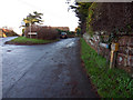
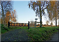
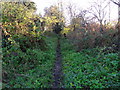
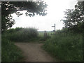
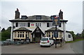
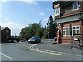
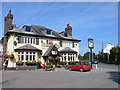
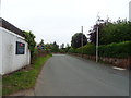
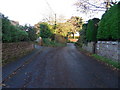
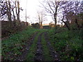
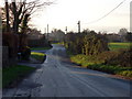
Photos of CH64 4AP

Area Information
CH64 4AP is a small residential postcode area in England, covering 3.5 hectares with a population of 1563 people. Its low population density of 97 people per square kilometre suggests a quiet, low-rise residential cluster. Neston, the town it belongs to, is a historic market town in Cheshire’s Wirral Peninsula, with roots in Viking-era settlements. The area’s name derives from Old Norse, reflecting its origins as a farmstead near a promontory that once jutted into the Dee Estuary. Today, Neston retains its tranquil countryside character, with a population of around 2,480 across its civil parish. Living here means being part of a community with a strong historical legacy, including a market charter granted in 1728 and a thriving Friday market still in operation. The area’s compact size and low density make it ideal for those seeking a peaceful, historically rich environment without the bustle of larger towns. Proximity to rail links and retail hubs adds practicality, while the town’s preserved architecture and market traditions offer a unique blend of heritage and modern convenience.
- Area Type
- Postcode
- Area Size
- 3.5 hectares
- Population
- 1563
- Population Density
- 97 people/km²
CH64 4AP is primarily an owner-occupied area, with 91% of homes owned by their residents. The accommodation type is predominantly houses, which is unusual for a small postcode area but reflects Neston’s traditional market town character. This suggests a housing stock that prioritises single-family homes over flats or apartments, which may appeal to buyers seeking spacious, private properties. The small size of the area—just 3.5 hectares—means the housing stock is limited, likely concentrated in a compact cluster of residences. For buyers, this implies a need to consider the broader Neston area for additional options, as the immediate postcode offers only a small number of properties. The high home ownership rate also indicates a stable market with little turnover, potentially making it a good choice for long-term investment. However, the lack of rental properties suggests limited flexibility for those requiring short-term or flexible housing solutions.
House Prices in CH64 4AP
Showing 20 properties
| Address | Type | Beds | Baths | Last Sale Price | Last Sale Date | |
|---|---|---|---|---|---|---|
| Birch Hey, Neston Road, Ness, Neston, CH64 4AP | house | - | - | £575,000 | Dec 2024 | |
| Longridge, Neston Road, Ness, Neston, CH64 4AP | Bungalow | 4 | - | £673,000 | Aug 2016 | |
| Paddock Hey, Neston Road, Ness, Neston, CH64 4AP | Detached | 5 | 4 | £540,000 | May 2016 | |
| Grays Lodge, Neston Road, Ness, Neston, CH64 4AP | Detached | 4 | 2 | £365,000 | May 2016 | |
| Hollydene, Neston Road, Ness, Neston, CH64 4AP | Detached | 4 | - | £470,000 | Jan 2014 | |
| Cambrian House, Neston Road, Ness, Neston, CH64 4AP | Detached | - | - | £477,500 | Jan 2013 | |
| The Beeches, Neston Road, Ness, Neston, CH64 4AP | Detached | 4 | 4 | £760,000 | Jun 2011 | |
| Hilversum, Neston Road, Ness, Neston, CH64 4AP | Detached | - | - | £560,000 | Oct 2007 | |
| Inglefield, Neston Road, Ness, Neston, CH64 4AP | Detached | - | - | £695,000 | Jul 2007 | |
| Lynhurst, Neston Road, Ness, Neston, CH64 4AP | Detached | - | - | £330,000 | Jan 2003 |
Energy Efficiency in CH64 4AP
Residents of CH64 4AP have access to a range of nearby amenities, including five retail outlets such as Tesco Neston, Sainsburys Neston, and Aldi Neston, ensuring convenience for shopping and daily essentials. The area’s rail network, with stations like Neston Railway Station and Hooton Railway Station, offers practical connectivity for commuting and travel. While the data does not specify parks or leisure facilities, Neston’s historic character includes landmarks like the Parish Church of St Mary and St Helen and the Neston Town Hall, which contribute to a culturally rich environment. The presence of a Friday market and monthly Farmer’s Market in Neston adds to the town’s vibrancy, offering opportunities for local shopping and social interaction. The combination of retail, rail access, and historical sites suggests a lifestyle that balances practicality with a connection to the area’s heritage.
Amenities
Schools
The nearest school to CH64 4AP is Bishop Wilson Church of England Primary School, which serves the local community with a good Ofsted rating. This primary school is the only educational institution explicitly mentioned in the data, meaning families with older children may need to look beyond the immediate area for secondary education. The presence of a primary school with a good rating is a positive factor for families with young children, offering a reliable local option for early education. However, the absence of secondary schools or further education facilities in the immediate vicinity could be a consideration for those planning for long-term schooling needs. The school’s rating suggests a focus on quality teaching and facilities, though specific details about its curriculum or extracurricular offerings are not provided.
| Rank | School | Type | Entry gender | Ages |
|---|
Explore more schools in this area
Go to Schools tabDemographics
The median age in CH64 4AP is 47, with the majority of residents aged between 30 and 64 years. This suggests a community of established adults, many of whom are likely to be long-term residents. Home ownership is exceptionally high at 91%, indicating a stable, owner-occupied demographic. The area is predominantly composed of houses, reflecting a traditional residential layout rather than apartments or flats. The predominant ethnic group is White, which aligns with broader trends in the region. With 91% of homes owned by residents, the area lacks significant rental activity, making it less typical of a transient or student-heavy population. The age profile suggests a mature community with potential for family-oriented living, though the absence of specific data on family sizes or deprivation levels means the area’s socioeconomic diversity remains unclear. The low population density and high home ownership also imply a focus on private, low-density housing rather than high-rise or shared accommodation.
Household Size
Accommodation Type
Tenure
Ethnic Group
Religion
Household Composition
Age
Household Deprivation
NS-SEC
Explore more demographic insights in this area
Go to Demographics tabPlanning
Planning Constraints
- Flood RiskPremium
- Ramsar Wetland SitesPremium
- Area of Outstanding Natural BeautyPremium
- Protected Nature ReservePremium
- Protected WoodlandPremium