Area Overview for CH64 3UG
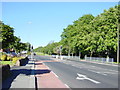
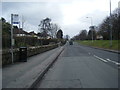
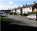
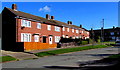
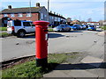
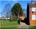
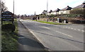
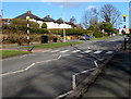
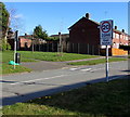
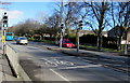
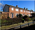
Photos of CH64 3UG

Area Information
Living in CH64 3UG means inhabiting a small, tightly knit residential cluster within the historic market town of Neston, Cheshire. This area, covering just 1.5 hectares, is home to 1,665 people, creating a community where familiarity and proximity are defining features. Neston itself, with its roots in Viking-era settlements and medieval trade, offers a blend of historical character and modern convenience. The town’s tranquil countryside setting contrasts with its past as a bustling port, now reflected in its preserved architecture and ongoing market traditions. Residents benefit from a low population density of 378 people per square kilometre, ensuring a sense of space without sacrificing access to amenities. The area’s compact size means daily life is centred around local institutions, from its historic parish church to the weekly Friday market. For those seeking a balance between heritage and practicality, CH64 3UG provides a snapshot of rural England’s enduring appeal, where the past is palpable and the present is quietly efficient.
- Area Type
- Postcode
- Area Size
- 1.5 hectares
- Population
- 1665
- Population Density
- 378 people/km²
The property market in CH64 3UG is characterised by a strong emphasis on owner-occupation, with 66% of homes owned by their residents. This contrasts with areas where rental demand drives the market, suggesting a community of long-term residents rather than transient tenants. The accommodation type is predominantly houses, which are more common than flats in this postcode. This housing stock aligns with the area’s low population density and historical development as a market town, where larger properties were traditionally built. For buyers, this means a limited but focused selection of homes, typically suited to families or individuals seeking space and privacy. The compact size of the area also means that properties are closely grouped, with little scope for new developments. Those considering CH64 3UG should expect a market where homes are likely to be well-maintained, reflecting the age of the population and the stability of the community.
House Prices in CH64 3UG
Showing 10 properties
Energy Efficiency in CH64 3UG
The lifestyle in CH64 3UG is shaped by its proximity to essential amenities, including retail outlets such as Aldi Neston, Sainsburys Neston, and Tesco Neston, which provide everyday shopping convenience. These stores cater to a range of needs, from groceries to household goods, reducing the necessity for long trips to larger centres. The rail network further enhances accessibility, with stations like Neston Railway Station offering links to surrounding areas. The area’s historical character is complemented by its practical amenities, creating a balance between heritage and modernity. For residents, this means a daily life where historical landmarks like the Parish Church of St Mary and St Helen coexist with the convenience of nearby shops and transport. The presence of a Friday market and monthly Farmer’s Market also adds to the vibrancy of local life, offering opportunities for social interaction and community engagement.
Amenities
Schools
Residents of CH64 3UG have access to a range of educational institutions, including Neston St Mary’s CofE Primary School, Raby Park County Junior School, and Neston High School. The latter is an academy with a Good Ofsted rating, indicating a strong educational offering for older students. The presence of both primary and secondary schools within the area ensures that families have options for their children’s education without needing to commute far. The mix of school types—state-funded and academy—reflects the diversity of educational approaches available. For parents, this means the ability to choose between traditional state schooling or the potentially more resource-rich environment of an academy. The proximity of these schools to residential areas underscores the area’s suitability for families, with education being a key consideration for homebuyers.
| Rank | School | Type | Entry gender | Ages |
|---|
Explore more schools in this area
Go to Schools tabDemographics
The population of CH64 3UG is predominantly middle-aged, with a median age of 47 and the most common age range being adults aged 30–64. This suggests a community with established careers and families, contributing to a stable local economy. Home ownership is strong, with 66% of residents owning their homes, a figure that indicates long-term residency and investment in the area. The accommodation type is primarily houses, reflecting a preference for detached or semi-detached properties over flats. The predominant ethnic group is White, which aligns with broader demographic trends in Cheshire. The absence of specific data on deprivation or diversity means the area’s social dynamics are not fully quantified, but the high home ownership rate and age profile suggest a community prioritising security and continuity over transient lifestyles. For prospective buyers, this demographic profile implies a neighbourhood where neighbours are likely to be long-term residents, fostering a cohesive local identity.
Household Size
Accommodation Type
Tenure
Ethnic Group
Religion
Household Composition
Age
Household Deprivation
NS-SEC
Explore more demographic insights in this area
Go to Demographics tabPlanning
Planning Constraints
- Flood RiskPremium
- Ramsar Wetland SitesPremium
- Area of Outstanding Natural BeautyPremium
- Protected Nature ReservePremium
- Protected WoodlandPremium