Area Overview for CH64 1SJ
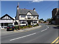
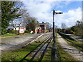
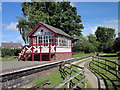
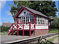
Photos of CH64 1SJ
Area Information
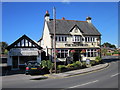
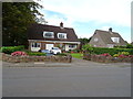
Living in CH64 1SJ means being part of a compact, residential cluster in the Wirral Peninsula, within Cheshire East. The area covers 3.1 hectares and is home to 1,315 people, translating to a population density of 421 people per square kilometre. This small postcode area sits within Willaston & Thornton Ward, a historically significant part of the Wirral, once part of the medieval township of Neston. Today, it is administered by Cheshire East and includes the village of Willaston, known for its historic roots and community-focused amenities. The area’s small size fosters a tight-knit feel, with residents likely to know their neighbours. Proximity to nearby villages like Thornton Hough and the broader Wirral Peninsula offers access to broader services while retaining a localised, village-like atmosphere. The area’s low crime risk and absence of environmental constraints such as protected woodlands or AONB designations make it a practical choice for those seeking a quiet, stable residential environment without the complexities of planning restrictions.
- Area Type
- Postcode
- Area Size
- 3.1 hectares
- Population
- 1315
- Population Density
- 421 people/km²
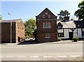
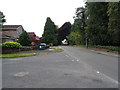
The property market in CH64 1SJ is characterised by high home ownership (94%) and a focus on houses, which dominate the accommodation type. This suggests a market where owner-occupation is the norm, with few rental properties available. The small area size—just 3.1 hectares—means the housing stock is likely limited to a modest number of properties, possibly older or traditional homes given the area’s historical roots. Buyers should expect a competitive market for available properties, with limited scope for new developments due to the area’s small footprint. The absence of planning constraints like AONB or protected nature reserves may make it easier to purchase or renovate properties, though the compact size means proximity to amenities and transport is critical. Those seeking a home here should prioritise properties that align with the local character, as the market is unlikely to cater to high-density or modernist preferences.
House Prices in CH64 1SJ
Showing 9 properties
| Address | Type | Beds | Baths | Last Sale Price | Last Sale Date | |
|---|---|---|---|---|---|---|
| 26 Hooton Road, Willaston, Neston, CH64 1SJ | Bungalow | 1 | 1 | £410,000 | Feb 2023 | |
| Edendale, Hooton Road, Willaston, Neston, CH64 1SJ | Detached | - | - | £523,000 | Dec 2020 | |
| Argyle, 24 Hooton Road, Willaston, Neston, CH64 1SJ | house | 2 | - | £350,000 | Jul 2014 | |
| Roundfell, 20 Hooton Road, Willaston, Neston, CH64 1SJ | house | 1 | - | £460,000 | Jan 2012 | |
| Shirley, 34 Hooton Road, Willaston, Neston, CH64 1SJ | Detached | - | - | £136,000 | Feb 1998 | |
| Fairways, Hooton Road, Willaston, Neston, CH64 1SJ | Detached | 2 | - | - | - | |
| Penny Family Farm, 36 Hooton Road, Willaston, Neston, CH64 1SJ | house | - | - | - | - | |
| White Rose, 22 Hooton Road, Willaston, Neston, CH64 1SJ | Detached | - | - | - | - | |
| Mayfield, 30 Hooton Road, Willaston, Neston, CH64 1SJ | Detached | - | - | - | - |
Energy Efficiency in CH64 1SJ
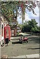
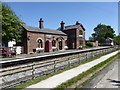
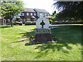
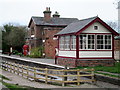
Residents of CH64 1SJ have access to a range of local amenities within practical reach. The retail scene includes Spar, Morrisons Eastham, and Tesco Eastham, offering essential shopping and dining options. These stores cater to daily needs, from groceries to convenience items. The area’s rail connectivity is strong, with Hooton, Eastham Rake, and Bromborough stations providing links to nearby towns and cities. For leisure, the village of Willaston features Willaston Primary School, a K6 telephone box converted into a book exchange, and community-managed spaces like Mike Heywood Green and Lettie Spencer playing field. These amenities reflect a focus on local engagement and historical preservation. While the area lacks large-scale entertainment venues, its proximity to the Wirral Peninsula offers opportunities for outdoor activities, including walking and cycling along the coastal routes. The blend of practical retail, transport options, and community spaces supports a balanced lifestyle.
Amenities
Schools
| Rank | School | Type | Entry gender | Ages |
|---|
Explore more schools in this area
Go to Schools tabDemographics
The community in CH64 1SJ is predominantly middle-aged, with a median age of 47 and the most common age range being adults aged 30–64. This suggests a mature, established population, likely with long-term ties to the area. Home ownership is exceptionally high at 94%, indicating a strong preference for property as a long-term investment. The accommodation type is largely houses, reflecting a residential character distinct from high-density housing. The predominant ethnic group is White, aligning with broader demographic trends in the Wirral. With a population density of 421 people per square kilometre, the area balances residential comfort with a sense of space. The data does not provide direct measures of deprivation, but the high home ownership and low crime risk suggest a stable, low-pressure environment for daily life.
Household Size
Accommodation Type
Tenure
Ethnic Group
Religion
Household Composition
Age
Household Deprivation
NS-SEC
Explore more demographic insights in this area
Go to Demographics tabPlanning
Planning Constraints
- Flood RiskPremium
- Ramsar Wetland SitesPremium
- Area of Outstanding Natural BeautyPremium
- Protected Nature ReservePremium
- Protected WoodlandPremium