Area Overview for CH64 0UB
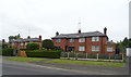
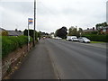
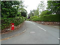
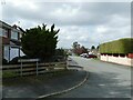
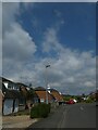
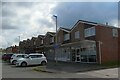
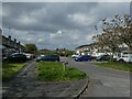
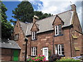
Photos of CH64 0UB
Area Information
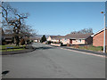
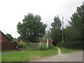
Living in CH64 0UB means being part of a small, densely populated residential cluster in England’s Cheshire countryside. The area covers 8,307 m² and is home to 1,425 residents, making it one of the most compact postcode areas in the region. Neston, the town associated with this postcode, is a historic market town with Viking-era roots, its name deriving from the Old Norse for “farmstead near a headland.” Today, it retains a tranquil character, with a strong sense of local identity. The community is predominantly middle-aged, with a median age of 47 and most residents aged between 30 and 64. This demographic suggests a stable, established population, with 89% owning their homes. Daily life here is shaped by the town’s heritage, including its Friday market and monthly Farmer’s Market, which continue to reflect its historic market town status. The proximity to retail hubs like Tesco Neston and Sainsburys Neston, along with nearby rail links, ensures practicality for residents. However, the area’s small size means its housing stock is limited, requiring buyers to consider nearby clusters for more options.
- Area Type
- Postcode
- Area Size
- 8307 m²
- Population
- 1425
- Population Density
- 4287 people/km²
The property market in CH64 0UB is defined by high home ownership (89%) and a focus on houses rather than flats or apartments. This suggests a community prioritising private, standalone residences, typical of rural or semi-rural areas. The small area size and limited housing stock mean the market is likely constrained, with limited scope for new developments. Buyers should consider nearby postcode clusters for additional options, as the immediate area offers few properties. The predominance of houses may appeal to those seeking space and privacy, though the high population density raises questions about land use efficiency. With no data on property prices or rental demand, the market’s affordability or competitiveness remains unclear. However, the strong home ownership rate indicates a stable, long-term resident base, which could be a factor for buyers seeking a low-turnover area.
House Prices in CH64 0UB
Showing 17 properties
| Address | Type | Beds | Baths | Last Sale Price | Last Sale Date | |
|---|---|---|---|---|---|---|
| 17 Turrocks Croft, Little Neston, Neston, CH64 0UB | Detached | 3 | - | £187,500 | Jan 2017 | |
| 19 Turrocks Croft, Little Neston, Neston, CH64 0UB | Detached | 4 | - | £208,000 | Jan 2013 | |
| 5 Turrocks Croft, Little Neston, Neston, CH64 0UB | Bungalow | - | - | £184,000 | Mar 2009 | |
| 7 Turrocks Croft, Little Neston, Neston, CH64 0UB | Detached | - | - | £72,000 | Jun 1998 | |
| 15 Turrocks Croft, Little Neston, Neston, CH64 0UB | Detached | - | - | £57,200 | Sep 1995 | |
| 4 Turrocks Croft, Little Neston, Neston, CH64 0UB | Detached | 3 | 1 | - | - | |
| 9 Turrocks Croft, Little Neston, Neston, CH64 0UB | Detached | - | - | - | - | |
| 1 Turrocks Croft, Little Neston, Neston, CH64 0UB | Detached | - | - | - | - | |
| 3 Turrocks Croft, Little Neston, Neston, CH64 0UB | Detached | - | - | - | - | |
| 8 Turrocks Croft, Little Neston, Neston, CH64 0UB | Detached | - | - | - | - |
Energy Efficiency in CH64 0UB
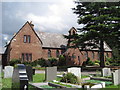
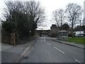
Life in CH64 0UB is shaped by its historic market town roots and practical amenities. The area’s retail options include major chains like Tesco Neston, Sainsburys Neston, and Aldi Neston, ensuring access to groceries and everyday essentials. For transport, nearby rail stations such as Neston Railway Station and Hooton Railway Station provide connections to regional hubs. Neston itself retains its market town character, with a Friday market and monthly Farmer’s Market that reflect its heritage. The town’s historic buildings, including the Parish Church of St Mary and St Helen and the 1889 Neston Town Hall, add cultural depth. While the area lacks large parks or leisure facilities, its small size and rural setting offer a quiet, community-focused lifestyle. The combination of practical amenities and historic charm makes it appealing for those seeking a balance between convenience and tradition.
Amenities
Schools
| Rank | School | Type | Entry gender | Ages |
|---|
Explore more schools in this area
Go to Schools tabDemographics
CH64 0UB’s population of 1,425 is concentrated in a small area, resulting in a high density of 171,545 people per km². The median age of 47 indicates a mature community, with the majority of residents aged between 30 and 64. This age range suggests a mix of working professionals and families, though the data does not specify the presence of children or younger adults. Home ownership is exceptionally high at 89%, reflecting a community of long-term residents rather than renters. The accommodation is predominantly houses, which aligns with the area’s rural character and limited high-density development. The predominant ethnic group is White, though no further breakdown of diversity is provided. This demographic profile implies a stable, low-turnover neighbourhood where residents are likely to have established roots. The absence of data on deprivation or income levels means the quality of life cannot be fully contextualised, but the high home ownership and age profile suggest a cohesive, settled community.
Household Size
Accommodation Type
Tenure
Ethnic Group
Religion
Household Composition
Age
Household Deprivation
NS-SEC
Explore more demographic insights in this area
Go to Demographics tabPlanning
Planning Constraints
- Flood RiskPremium
- Ramsar Wetland SitesPremium
- Area of Outstanding Natural BeautyPremium
- Protected Nature ReservePremium
- Protected WoodlandPremium