Area Overview for CH63 9JZ
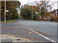
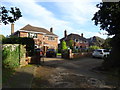
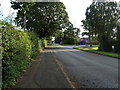
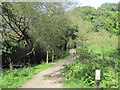
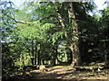
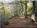
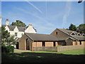
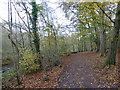
Photos of CH63 9JZ


Area Information
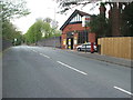
Living in CH63 9JZ means inhabiting a tightly packed residential cluster in the Wirral Peninsula, centred around the coordinates 53.348903782430995, -3.002949350686688. This small area, spanning just 1.4 hectares, is home to 1,405 residents, making it one of the most densely populated postcode areas in England, with 98,206 people per square kilometre. The neighbourhood is defined by its proximity to Clatterbridge Hospital and Clatterbridge Cancer Centre, landmarks that anchor the area’s identity. Historically, the site was a workhouse built in 1836, later evolving into a major healthcare hub. Today, it serves as a focal point for medical services, with the hospital and cancer centre offering advanced treatments like proton therapy. The area’s compact size means daily life is shaped by close proximity to these institutions, creating a community that is both functional and tightly knit. While the high density might feel intense, the presence of essential services and transport links ensures convenience for residents.
- Area Type
- Postcode
- Area Size
- 1.4 hectares
- Population
- 1405
- Population Density
- 1912 people/km²
The property market in CH63 9JZ is dominated by owner-occupied homes, with 92% of properties owned outright. This high level of home ownership suggests a community of long-term residents rather than a transient rental market. The accommodation type is exclusively houses, which is unusual for a small postcode area but aligns with the presence of larger residential clusters in the Wirral Peninsula. Given the area’s compact size and high population density, the housing stock is limited, making it a niche market for buyers seeking proximity to healthcare facilities. The dominance of owner-occupied properties may indicate strong local demand, but the small area size means opportunities for new development are constrained. Buyers should consider the proximity to Clatterbridge Hospital and the surrounding infrastructure when evaluating property value and long-term viability.
House Prices in CH63 9JZ
Showing 22 properties
| Address | Type | Beds | Baths | Last Sale Price | Last Sale Date | |
|---|---|---|---|---|---|---|
| 8 Woodkind Hey, Spital, CH63 9JZ | house | - | - | £465,000 | Mar 2023 | |
| 18 Woodkind Hey, Spital, CH63 9JZ | Detached | 4 | 1 | £520,000 | Sep 2022 | |
| 36 Woodkind Hey, Spital, CH63 9JZ | Detached | 4 | 3 | £456,000 | Oct 2017 | |
| 34 Woodkind Hey, Spital, CH63 9JZ | house | - | - | £382,000 | Oct 2016 | |
| 24 Woodkind Hey, Spital, CH63 9JZ | house | - | - | £305,000 | Mar 2011 | |
| 42 Woodkind Hey, Spital, CH63 9JZ | house | - | - | £220,000 | Nov 2010 | |
| 40 Woodkind Hey, Spital, CH63 9JZ | Bungalow | - | - | £235,000 | Nov 2010 | |
| 16 Woodkind Hey, Spital, CH63 9JZ | house | - | - | £270,000 | Aug 2010 | |
| 32 Woodkind Hey, Spital, CH63 9JZ | Detached | - | - | £400,000 | Mar 2008 | |
| 26 Woodkind Hey, Spital, CH63 9JZ | Detached | - | - | £250,000 | Jul 2004 |
Energy Efficiency in CH63 9JZ
Daily life in CH63 9JZ is shaped by its proximity to essential amenities. Retail options include M&S Spital BP, Co-op Cross, and Lidl Bromborough, providing a range of shopping and dining choices. The area’s rail network, with stations like Spital and Bromborough Rake, connects residents to nearby towns and cities, while ferry terminals offer access to Liverpool and Birkenhead. The presence of Clatterbridge Hospital and Cancer Centre adds a layer of medical convenience, though the area’s small size means leisure and recreational spaces are limited to nearby public areas. Despite this, the density of services ensures that most needs are met within a short distance, fostering a practical, efficient lifestyle for residents.
Amenities
Schools
| Rank | School | Type | Entry gender | Ages |
|---|
Explore more schools in this area
Go to Schools tabDemographics
The population of CH63 9JZ has a median age of 47, with the most common age range being adults aged 30–64. This suggests a mature, stable community with a strong presence of middle-aged and older residents. Home ownership is exceptionally high at 92%, indicating a predominantly owner-occupied area with long-term residents. The accommodation type is primarily houses, reflecting a residential character distinct from high-rise or shared housing. The predominant ethnic group is White, though no specific data on diversity or deprivation is provided. The age profile and home ownership rates suggest a low turnover of residents, fostering a sense of continuity. With 92% of homes owned by their occupants, the area likely experiences fewer rental-related disruptions, contributing to a cohesive local environment.
Household Size
Accommodation Type
Tenure
Ethnic Group
Religion
Household Composition
Age
Household Deprivation
NS-SEC
Explore more demographic insights in this area
Go to Demographics tabPlanning
Planning Constraints
- Flood RiskPremium
- Ramsar Wetland SitesPremium
- Area of Outstanding Natural BeautyPremium
- Protected Nature ReservePremium
- Protected WoodlandPremium