Area Overview for CH63 9JU
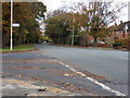
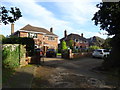
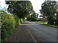
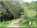
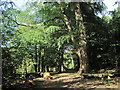
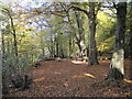
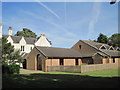
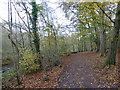
Photos of CH63 9JU


Area Information
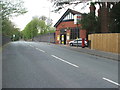
Living in CH63 9JU means being part of a tightly knit residential cluster in the Wirral Peninsula, centred around Clatterbridge Health Park. This small area, spanning just 2.1 hectares, is home to 1,182 residents, creating a high population density of 55,153 people per square kilometre. The area’s identity is shaped by its proximity to Clatterbridge Hospital and the Clatterbridge Cancer Centre, which have long defined the local landscape. While the postcode is primarily residential, its compact size means daily life is closely tied to nearby amenities and transport links. The community is marked by a mature demographic, with a median age of 47 and a significant proportion of elderly residents. This suggests a stable, low-turnover environment, ideal for those seeking a quiet, established neighbourhood. Despite its small footprint, CH63 9JU is well-connected to surrounding areas, offering a balance of local convenience and access to broader regional infrastructure. For buyers, this area appeals to those prioritising proximity to healthcare facilities and a sense of community over expansive space.
- Area Type
- Postcode
- Area Size
- 2.1 hectares
- Population
- 1182
- Population Density
- 2445 people/km²
The property market in CH63 9JU is characterised by high home ownership (95%) and a predominance of houses, indicating a focus on owner-occupied residences rather than rental properties. This suggests a mature market with limited turnover, as the area’s compact size and high density mean few new developments are likely. The concentration of houses implies a mix of semi-detached and detached homes, typical of suburban areas. For buyers, this presents a niche opportunity: properties are likely to be well-maintained, with long-term residents contributing to a stable market. However, the small area size and high population density may limit availability, making it a competitive market for those seeking immediate purchase. Proximity to Clatterbridge Hospital and the cancer centre could be a draw for buyers prioritising healthcare access, though the lack of commercial or industrial land use means the area remains residential-focused.
House Prices in CH63 9JU
Showing 37 properties
| Address | Type | Beds | Baths | Last Sale Price | Last Sale Date | |
|---|---|---|---|---|---|---|
| 1 Dibbins Hey, Spital, CH63 9JU | Detached | 3 | 1 | £425,000 | May 2025 | |
| 5 Dibbins Hey, Spital, CH63 9JU | house | 4 | 2 | £540,000 | May 2023 | |
| 23 Dibbins Hey, Spital, CH63 9JU | Detached | 3 | 1 | £245,000 | Apr 2023 | |
| 53 Dibbins Hey, Spital, CH63 9JU | house | - | - | £340,000 | Mar 2023 | |
| 35 Dibbins Hey, Spital, CH63 9JU | house | - | - | £318,550 | Jul 2022 | |
| 61 Dibbins Hey, Spital, CH63 9JU | house | - | - | £320,000 | Nov 2021 | |
| 49 Dibbins Hey, Spital, CH63 9JU | Detached | 3 | - | £282,500 | Sep 2021 | |
| 73 Dibbins Hey, Spital, CH63 9JU | house | 3 | 1 | £253,000 | Sep 2018 | |
| 7 Dibbins Hey, Spital, CH63 9JU | Detached | 3 | 1 | £314,000 | Aug 2017 | |
| 69 Dibbins Hey, Spital, CH63 9JU | house | - | - | £258,950 | Apr 2017 |
Energy Efficiency in CH63 9JU
Living in CH63 9JU offers a blend of local convenience and regional connectivity. The area’s proximity to Spital Railway Station and Bromborough Rake Railway Station provides easy access to nearby towns, while ferry terminals like Woodside Birkenhead and Liverpool Pier Head offer direct links to the city. Retail options include M&S Spital BP, Co-op Cross, and Aldi Bromborough, catering to everyday shopping needs. The presence of Liverpool John Lennon Airport within reach adds flexibility for travel. For leisure, the area’s compact size means amenities are within walking or short driving distance, though larger parks or recreational facilities may require a trip to nearby locations. The character of the area is defined by its residential focus and proximity to healthcare facilities, creating a quiet, community-oriented environment. While the immediate surroundings lack expansive green spaces, the nearby Wirral Peninsula offers broader opportunities for outdoor activities. Overall, CH63 9JU provides a practical lifestyle with a focus on accessibility and local essentials.
Amenities
Schools
The nearest school to CH63 9JU is Poulton Lancelyn Primary School, which serves the local community. The school is listed twice in the data, though it appears to be a single institution. As a primary school, it caters to children aged 4–11, providing foundational education for families in the area. While no Ofsted rating is provided, the presence of a primary school within reach is a key consideration for parents. The absence of secondary schools or other educational institutions in the immediate vicinity means families may need to travel to nearby towns for higher education. However, the proximity of the primary school supports a localised approach to schooling, reducing the need for long commutes. For buyers prioritising family-friendly amenities, the availability of a primary school is a significant asset, though further research would be needed to assess its academic performance and facilities.
| Rank | School | Type | Entry gender | Ages |
|---|
Explore more schools in this area
Go to Schools tabDemographics
The community in CH63 9JU is predominantly elderly, with a median age of 47 and the most common age range being 65+ years. This indicates a mature population, likely with long-standing ties to the area. Home ownership is exceptionally high at 95%, reflecting a stable, owner-occupied demographic. The accommodation type is primarily houses, suggesting a mix of semi-detached and detached properties typical of suburban settings. The predominant ethnic group is White, which aligns with broader trends in the Wirral Peninsula. The high home ownership rate and elderly population imply a low turnover of residents, fostering a sense of continuity. However, this also means the area may lack the dynamism of younger, growing communities. The absence of specific data on deprivation or diversity means the quality of life is inferred from the stability and infrastructure rather than socioeconomic metrics. For buyers, this profile suggests a quiet, low-maintenance environment with limited demand for rental properties.
Household Size
Accommodation Type
Tenure
Ethnic Group
Religion
Household Composition
Age
Household Deprivation
NS-SEC
Explore more demographic insights in this area
Go to Demographics tabPlanning
Planning Constraints
- Flood RiskPremium
- Ramsar Wetland SitesPremium
- Area of Outstanding Natural BeautyPremium
- Protected Nature ReservePremium
- Protected WoodlandPremium