Area Overview for CH63 9JD
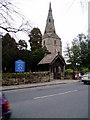
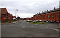
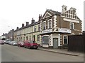
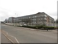
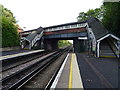
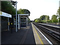
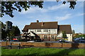
Photos of CH63 9JD


Area Information
CH63 9JD is a small, densely populated residential postcode area in Wirral, England, covering 2,371 square metres and home to 1,182 residents. Its compact size and high population density of 498,445 people per square kilometre reflect a tightly knit community centred around Clatterbridge, a ward known for its healthcare infrastructure. The area’s identity is shaped by Clatterbridge Hospital and the Clatterbridge Cancer Centre, which have long been focal points for medical services in the region. Despite its small footprint, the area is strategically located on the Wirral Peninsula, offering proximity to both urban amenities and natural landscapes. Daily life here is characterised by a mix of quiet residential streets and access to nearby transport networks, making it suitable for those seeking a balance between convenience and a slower pace. The predominantly elderly population and high home ownership rate suggest a community rooted in stability, with many residents likely to have lived in the area for extended periods.
- Area Type
- Postcode
- Area Size
- 2371 m²
- Population
- 1182
- Population Density
- 2445 people/km²
The property market in CH63 9JD is dominated by owner-occupied homes, with 95% of properties owned outright rather than rented. This high ownership rate suggests a community of long-term residents, likely contributing to a stable and mature housing market. The accommodation type is predominantly houses, which is unusual for areas with high population density, indicating a mix of larger, more spacious properties within a confined area. Given the postcode’s small size, the housing stock is limited, which may make the area appealing to buyers seeking established homes in a quiet, low-density setting. However, the lack of rental properties could reduce flexibility for those needing short-term or flexible housing solutions. The high home ownership rate also implies strong local ties, potentially influencing property values and the character of the neighbourhood.
House Prices in CH63 9JD
Showing 13 properties
| Address | Type | Beds | Baths | Last Sale Price | Last Sale Date | |
|---|---|---|---|---|---|---|
| 11, Mobberley Court, Mobberley Way, Spital, CH63 9JD | Flat | - | - | £125,625 | Mar 2008 | |
| 12, Mobberley Court, Mobberley Way, Spital, CH63 9JD | Flat | - | - | £99,000 | Mar 2008 | |
| 3, Mobberley Court, Mobberley Way, Spital, CH63 9JD | Flat | - | - | £82,500 | Feb 2008 | |
| 4, Mobberley Court, Mobberley Way, Spital, CH63 9JD | Flat | - | - | - | - | |
| 14, Mobberley Court, Mobberley Way, Spital, CH63 9JD | Flat | - | - | - | - | |
| 1, Mobberley Court, Mobberley Way, Spital, CH63 9JD | Bungalow | - | - | - | - | |
| 9, Mobberley Court, Mobberley Way, Spital, CH63 9JD | Flat | - | - | - | - | |
| 2, Mobberley Court, Mobberley Way, Spital, CH63 9JD | Flat | - | - | - | - | |
| 5, Mobberley Court, Mobberley Way, Spital, CH63 9JD | Flat | - | - | - | - | |
| 10, Mobberley Court, Mobberley Way, Spital, CH63 9JD | Flat | - | - | - | - |
Energy Efficiency in CH63 9JD
Residents of CH63 9JD have access to a range of nearby amenities that support daily life. Retail options include M&S Spital BP, Co-op Cross, and Aldi Bromborough, offering a mix of grocery and general shopping needs. The area’s rail network, with stations like Spital and Port Sunlight, provides convenient links to surrounding towns and cities. Ferry terminals such as Birkenhead and Liverpool Pier Head enable easy travel across the Mersey, while the proximity to Liverpool John Lennon Airport adds to the area’s connectivity. Although the data does not specify parks or leisure facilities, the presence of multiple retail and transport hubs suggests a practical, service-oriented lifestyle. The combination of local shops, transport links, and regional accessibility ensures that residents can meet both everyday and broader travel needs without significant inconvenience.
Amenities
Schools
The nearest school to CH63 9JD is Poulton Lancelyn Primary School, which serves the local community with primary education. While no Ofsted rating is provided in the data, the presence of a primary school suggests that families with young children may find the area suitable for their needs. However, the absence of secondary schools or additional educational institutions in the immediate vicinity could necessitate commuting for older students. The single primary school listed may indicate a focus on early education within the area, though the lack of diversity in school types might limit options for families requiring a broader range of educational provisions. Parents should consider the proximity of secondary schools in surrounding areas when evaluating the long-term suitability of CH63 9JD for their children’s education.
| Rank | School | Type | Entry gender | Ages |
|---|
Explore more schools in this area
Go to Schools tabDemographics
The demographic profile of CH63 9JD is defined by a median age of 47, with the elderly (65+ years) forming the most common age group. This suggests a community with a significant proportion of retired individuals, which may influence local services and amenities. Home ownership is exceptionally high at 95%, indicating a strong preference for long-term residency over rental properties. The accommodation type is primarily houses, reflecting a more traditional, family-oriented housing stock. The predominant ethnic group is White, with no specific data on diversity or deprivation levels provided. The high home ownership rate and older demographic may contribute to a stable, low-turnover environment, though the lack of younger residents could impact local schools and community dynamics. The area’s compact size and concentrated population further reinforce its character as a cohesive, established neighbourhood.
Household Size
Accommodation Type
Tenure
Ethnic Group
Religion
Household Composition
Age
Household Deprivation
NS-SEC
Explore more demographic insights in this area
Go to Demographics tabPlanning
Planning Constraints
- Flood RiskPremium
- Ramsar Wetland SitesPremium
- Area of Outstanding Natural BeautyPremium
- Protected Nature ReservePremium
- Protected WoodlandPremium