Area Overview for CH63 9HE
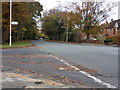
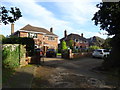
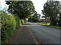
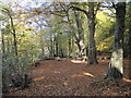
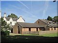
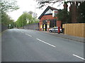
Photos of CH63 9HE


Area Information
Living in CH63 9HE means inhabiting a compact, residential postcode area within the Wirral Peninsula, centred around Clatterbridge’s healthcare infrastructure. With a population of 1,405 spread over 3.2 hectares, this area is densely populated but retains a focused character. Its history as the former Clatterbridge Workhouse, later transformed into a hospital and cancer centre, shapes its identity. The area is defined by Clatterbridge Hospital and the Clatterbridge Cancer Centre, which offer specialist medical services, including the UK’s only low-energy proton therapy unit for eye tumours. Daily life here is shaped by proximity to healthcare facilities, with residents benefiting from nearby rail stations, retail outlets, and ferry links. The high home ownership rate (92%) suggests a stable, long-term community, with most properties being houses rather than flats. CH63 9HE’s location on the Wirral Peninsula provides easy access to Liverpool and Birkenhead, while its small size means a tight-knit, localised environment.
- Area Type
- Postcode
- Area Size
- 3.2 hectares
- Population
- 1405
- Population Density
- 1912 people/km²
CH63 9HE is a predominantly owner-occupied area, with 92% of homes owned by residents rather than rented. The accommodation type is largely houses, which is unusual for a small postcode area but aligns with the historical development of the region, which prioritised single-family homes. The high home ownership rate and focus on houses suggest a mature housing stock with limited new builds, creating a competitive market for buyers. With a population density of 43,858 people per km², the area is densely populated, meaning properties are likely to be in close proximity to one another. This compact layout may limit availability of larger homes or newer developments, making CH63 9HE a niche market for those seeking established, owner-occupied housing in a historically significant part of Wirral.
House Prices in CH63 9HE
Showing 42 properties
| Address | Type | Beds | Baths | Last Sale Price | Last Sale Date | |
|---|---|---|---|---|---|---|
| 96 Dibbins Hey, Spital, CH63 9HE | house | - | - | £367,500 | Dec 2025 | |
| 115 Dibbins Hey, Spital, CH63 9HE | Detached | 4 | 1 | £396,280 | Oct 2025 | |
| 92 Dibbins Hey, Spital, CH63 9HE | Detached | 3 | 1 | £310,000 | Jun 2025 | |
| 104 Dibbins Hey, Spital, CH63 9HE | Detached | 3 | 1 | £402,500 | May 2025 | |
| 163 Dibbins Hey, Spital, CH63 9HE | Bungalow | 2 | 1 | £245,000 | Feb 2025 | |
| 161 Dibbins Hey, Spital, CH63 9HE | Bungalow | 2 | 1 | £251,000 | Dec 2024 | |
| 90 Dibbins Hey, Spital, CH63 9HE | Detached | 3 | 1 | £325,000 | Dec 2023 | |
| 100 Dibbins Hey, Spital, CH63 9HE | house | - | - | £300,000 | Jul 2023 | |
| 109 Dibbins Hey, Spital, CH63 9HE | Bungalow | - | - | £267,000 | Mar 2023 | |
| 103 Dibbins Hey, Spital, CH63 9HE | Bungalow | - | - | £395,000 | Nov 2022 |
Energy Efficiency in CH63 9HE
Residents of CH63 9HE have access to a range of amenities within practical reach. Retail options include M&S Spital BP, Lidl Bromborough, and Co-op Bromborough, offering everyday shopping needs. The area’s rail network, with stations such as Spital and Port Sunlight, provides easy access to nearby towns and cities. Ferry terminals at Woodside Birkenhead and Liverpool Pier Head connect the area to both sides of the Mersey, facilitating travel to Liverpool and beyond. While the postcode itself is small, its proximity to Clatterbridge Hospital and the Clatterbridge Cancer Centre adds a distinct character, with healthcare services shaping the local landscape. The combination of retail, transport, and healthcare infrastructure ensures a convenient, well-connected lifestyle for residents.
Amenities
Schools
| Rank | School | Type | Entry gender | Ages |
|---|
Explore more schools in this area
Go to Schools tabDemographics
CH63 9HE’s population skews towards adults aged 30–64, with a median age of 47. This suggests a community of middle-aged residents, likely including professionals, retirees, and families. The 92% home ownership rate indicates a predominantly owner-occupied area, with most residents living in houses rather than flats. The predominant ethnic group is White, reflecting the broader demographics of the Wirral Peninsula. The high population density (43,858 people per km²) for such a small area implies a compact, possibly older housing stock. While no specific deprivation data is provided, the low crime risk (92/100) and absence of flood or planning constraints suggest a stable, low-risk environment. This demographic profile points to a community with established roots, where most residents are likely to have lived in the area for several years.
Household Size
Accommodation Type
Tenure
Ethnic Group
Religion
Household Composition
Age
Household Deprivation
NS-SEC
Explore more demographic insights in this area
Go to Demographics tabPlanning
Planning Constraints
- Flood RiskPremium
- Ramsar Wetland SitesPremium
- Area of Outstanding Natural BeautyPremium
- Protected Nature ReservePremium
- Protected WoodlandPremium