Area Overview for CH63 9AQ
Photos of CH63 9AQ


Area Information
CH63 9AQ is a small residential cluster in Wirral, England, centred around the Wirral Peninsula. With a population of 1,452 spread across 5,545 square metres, it is densely populated yet retains a distinct identity shaped by its proximity to Clatterbridge Hospital and Clatterbridge Cancer Centre. The area’s history as a former workhouse, later transformed into a major healthcare hub, underpins its modern character. Residents benefit from being near key medical facilities, including the UK’s only low-energy proton therapy unit for eye tumours. The postcode’s location on the Wirral Peninsula offers easy access to nearby towns and cities via rail and ferry networks. Daily life here is defined by a balance of healthcare infrastructure, practical connectivity, and a tight-knit community feel. While the area is compact, its proximity to amenities like Spital Railway Station and Woodside Birkenhead Ferry Terminal ensures residents can reach larger urban centres swiftly. The high population density means the area is well-served by local services, though its small size means it is best suited for those prioritising accessibility over expansive living space.
- Area Type
- Postcode
- Area Size
- 5545 m²
- Population
- 1452
- Population Density
- 4523 people/km²
The property market in CH63 9AQ is dominated by owner-occupied homes, with 85% of residents living in houses rather than flats or rental properties. This reflects a community prioritising private ownership and long-term residency. The small area size and high population density suggest limited housing stock, making the local market potentially competitive for buyers. The focus on houses rather than apartments indicates a preference for traditional family homes, though the exact range of property types is not specified. For buyers, this means the area is best suited for those seeking a home in a compact, well-served postcode with strong healthcare and transport links. However, the limited size of CH63 9AQ may require buyers to consider nearby areas for more options.
House Prices in CH63 9AQ
Showing 9 properties
| Address | Type | Beds | Baths | Last Sale Price | Last Sale Date | |
|---|---|---|---|---|---|---|
| 6 Frensham Close, Spital, CH63 9AQ | Bungalow | - | - | £255,000 | Nov 2020 | |
| 8 Frensham Close, Spital, CH63 9AQ | Bungalow | 3 | - | £295,000 | Nov 2016 | |
| 10 Frensham Close, Spital, CH63 9AQ | Bungalow | - | - | £250,000 | May 2016 | |
| 1 Frensham Close, Spital, CH63 9AQ | Detached | 2 | - | £185,000 | Jul 2013 | |
| 3 Frensham Close, Spital, CH63 9AQ | Detached | - | - | £190,000 | Nov 2005 | |
| 5 Frensham Close, Spital, CH63 9AQ | Detached | - | - | - | - | |
| 2 Frensham Close, Spital, CH63 9AQ | Detached | - | - | - | - | |
| 12 Frensham Close, Spital, CH63 9AQ | Detached | - | - | - | - | |
| 4 Frensham Close, Spital, CH63 9AQ | Bungalow | - | - | - | - |
Energy Efficiency in CH63 9AQ
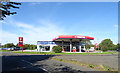
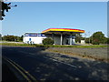
Living in CH63 9AQ offers access to a range of practical amenities within walking or short driving distance. Retail options include M&S Spital BP, Co-op Cross, and Co-op Teehey, providing everyday shopping needs. The area’s rail network, with stations like Spital and Bromborough Rake, connects residents to nearby towns and cities, while ferry terminals such as Birkenhead and Liverpool Pier Head offer quick crossings to the mainland. Though the area is small, its proximity to Clatterbridge Hospital and Cancer Centre ensures access to specialist healthcare. The presence of multiple transport hubs and retail outlets creates a convenient, efficient lifestyle, ideal for those valuing accessibility over expansive leisure spaces. The compact nature of the postcode means amenities are closely clustered, reducing travel time for daily tasks.
Amenities
Schools
| Rank | School | Type | Entry gender | Ages |
|---|
Explore more schools in this area
Go to Schools tabDemographics
The community in CH63 9AQ is predominantly middle-aged, with a median age of 47 and 85% of residents owning their homes. The most common age range is 30–64 years, indicating a population of working-age adults and older professionals. Over 85% of households are owner-occupied, with houses being the primary accommodation type. This suggests a stable, long-term resident base rather than a transient rental market. The predominant ethnic group is White, though no specific diversity statistics are provided. The high home ownership rate and age profile imply a community focused on established living, with limited presence of younger families or students. The area’s density—261,857 people per square kilometre—means it is highly populated for its size, which can influence local services and social dynamics.
Household Size
Accommodation Type
Tenure
Ethnic Group
Religion
Household Composition
Age
Household Deprivation
NS-SEC
Explore more demographic insights in this area
Go to Demographics tabPlanning
Planning Constraints
- Flood RiskPremium
- Ramsar Wetland SitesPremium
- Area of Outstanding Natural BeautyPremium
- Protected Nature ReservePremium
- Protected WoodlandPremium