Area Overview for CH63 8QR
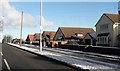
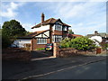
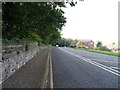
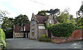
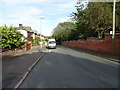
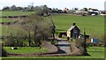
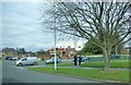
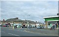
Photos of CH63 8QR
Area Information
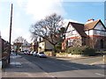
Living in CH63 8QR means being part of a small, tightly knit residential cluster in the Wirral, England. With a population of 1,596 spread over 2,177 square metres, the area has a population density of 263 people per square kilometre, reflecting a compact, community-focused environment. Situated in the historic ward of Bebington, this postcode sits on the ancient trade route between Chester and Birkenhead, a legacy that still influences its character today. The area blends rural tranquillity with practical connectivity, with rail stations and ferry terminals within easy reach. Residents benefit from proximity to the Church of St. Andrew, a Saxon-era landmark, and the conservation area heritage trail, which highlights the region’s Anglo-Saxon roots. The village of Bebington, with its medieval architecture and historical significance, offers a unique blend of heritage and modern convenience. Daily life here is shaped by its strategic location, with easy access to nearby towns and amenities, making it ideal for those seeking a balance between historical charm and contemporary living.
- Area Type
- Postcode
- Area Size
- 2177 m²
- Population
- 1596
- Population Density
- 263 people/km²
The property market in CH63 8QR is dominated by owner-occupied homes, with 83% of properties owned by their residents. This high rate of home ownership suggests a stable, long-term community with limited rental activity. The accommodation type is primarily houses, which is typical of suburban or semi-rural areas. Given the small area size and low population density, the housing stock is likely to be limited, with properties concentrated in a compact cluster. For buyers, this means a focus on individual homes rather than apartments or larger developments. The limited scale of the area may also mean that properties are in higher demand, particularly for those seeking a quieter, family-oriented environment. Proximity to transport links and amenities such as rail stations and retail hubs adds to the appeal, making CH63 8QR an attractive option for those prioritising stability and convenience.
House Prices in CH63 8QR
Showing 17 properties
| Address | Type | Beds | Baths | Last Sale Price | Last Sale Date | |
|---|---|---|---|---|---|---|
| 2 Sandfield Road, Higher Bebington, CH63 8QR | Terraced | 2 | 1 | £153,000 | Aug 2025 | |
| 3 Sandfield Road, Higher Bebington, CH63 8QR | Terraced | 2 | 1 | £185,000 | Apr 2024 | |
| 16 Sandfield Road, Higher Bebington, CH63 8QR | house | - | - | £119,995 | Nov 2020 | |
| 1 Sandfield Road, Higher Bebington, CH63 8QR | Terraced | 2 | 1 | £137,000 | Sep 2020 | |
| 9 Sandfield Road, Higher Bebington, CH63 8QR | house | - | - | £135,000 | Feb 2019 | |
| 7 Sandfield Road, Higher Bebington, CH63 8QR | Terraced | 2 | 1 | £97,000 | Jun 2015 | |
| 15 Sandfield Road, Higher Bebington, CH63 8QR | Terraced | - | - | £99,000 | Mar 2004 | |
| 8 Sandfield Road, Higher Bebington, CH63 8QR | Terraced | - | - | £38,000 | Jan 1997 | |
| 4 Sandfield Road, Higher Bebington, CH63 8QR | Terraced | - | - | - | - | |
| 18 Sandfield Road, Higher Bebington, CH63 8QR | house | 2 | 1 | - | - |
Energy Efficiency in CH63 8QR
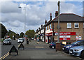
Residents of CH63 8QR have access to a range of amenities that support both practical needs and leisure activities. The area is served by five retail outlets, including Sainsburys Bebington and Tesco Birkenhead, offering everyday shopping convenience. For transport, five rail stations—such as Bebington and Rock Ferry—provide easy access to nearby towns, while three ferry terminals, including Woodside Birkenhead and Liverpool Pier Head, connect to Merseyside’s waterways. The historical and cultural richness of the area adds to its appeal, with landmarks like the Church of St. Andrew and the conservation area heritage trail offering a glimpse into the region’s Anglo-Saxon past. The presence of retail, transport, and historical sites creates a lifestyle that balances modern convenience with a sense of local identity, making daily life in CH63 8QR both practical and enriching.
Amenities
Schools
The nearest school to CH63 8QR is Higher Bebington Junior School, a primary school with an Ofsted rating of ‘good’. This institution serves the local community, providing education for younger children in the area. The absence of secondary schools within the immediate vicinity means families may need to consider commuting to nearby towns for secondary education. However, the presence of a well-rated primary school is a significant advantage for families with young children, offering a solid foundation for early education. The school’s rating indicates a satisfactory standard of teaching and facilities, which is important for parents prioritising quality education. While the data does not provide information on other educational institutions, the availability of a primary school contributes to the area’s appeal for families seeking a balanced lifestyle with accessible schooling options.
| Rank | School | Type | Entry gender | Ages |
|---|
Explore more schools in this area
Go to Schools tabDemographics
The demographic profile of CH63 8QR is defined by its mature population, with a median age of 47 and the majority of residents aged between 30 and 64. This suggests a community with a strong presence of established families and professionals. Home ownership is high, with 83% of properties occupied by their owners, indicating a stable and long-term resident base. The predominant accommodation type is houses, reflecting a suburban or semi-rural character. The predominant ethnic group is White, aligning with broader trends in the Wirral. The age distribution and ownership rates suggest a low turnover of properties, which can contribute to a sense of continuity and community cohesion. While the data does not specify deprivation levels, the high home ownership and stable age profile imply a relatively secure economic environment, though this does not preclude individual variations in household circumstances.
Household Size
Accommodation Type
Tenure
Ethnic Group
Religion
Household Composition
Age
Household Deprivation
NS-SEC
Explore more demographic insights in this area
Go to Demographics tabPlanning
Planning Constraints
- Flood RiskPremium
- Ramsar Wetland SitesPremium
- Area of Outstanding Natural BeautyPremium
- Protected Nature ReservePremium
- Protected WoodlandPremium