Area Overview for CH63 8NW
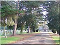
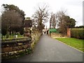
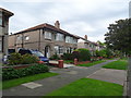
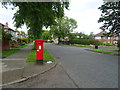
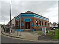
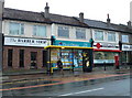
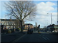
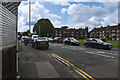
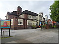
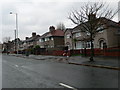
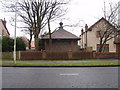
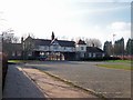
Photos of CH63 8NW
Area Information
Living in CH63 8NW means being part of a tightly knit residential cluster in the Wirral, a small postcode area with a population of 1,483 spread across 4,305 square metres. This density creates a compact, community-focused environment, where the historical significance of Bebington—once a strategic trading hub between Chester and Birkenhead—still lingers. The area is steeped in Anglo-Saxon heritage, with the Church of St. Andrew standing as a testament to its past. Modern life here balances convenience with tradition: residents benefit from proximity to rail and ferry networks, while the surrounding landscape offers a quiet contrast to the bustling nearby cities. The median age of 47 suggests a mature demographic, with many residents in their prime working years. This is a place where history meets practicality, offering a mix of established housing and accessible amenities that cater to daily needs without the sprawl of larger towns.
- Area Type
- Postcode
- Area Size
- 4305 m²
- Population
- 1483
- Population Density
- 6439 people/km²
CH63 8NW is predominantly an owner-occupied area, with 60% of homes owned by residents rather than rented. The accommodation type is largely houses, which is uncommon in many modern urban areas. This suggests a mix of older, established properties and perhaps some newer developments, though the exact age of the housing stock is not specified. The compact size of the postcode means the market is limited in scope, with buyers needing to consider nearby areas for more options. The high home ownership rate indicates a community with long-term residents, which can be appealing for those seeking a stable, low-turnover environment. However, the small size of the area may mean limited choice for buyers, requiring a focus on proximity to essential services and transport links.
House Prices in CH63 8NW
Showing 9 properties
| Address | Type | Beds | Baths | Last Sale Price | Last Sale Date | |
|---|---|---|---|---|---|---|
| 35 Kings Lane, Higher Bebington, CH63 8NW | Detached | 3 | 1 | £285,000 | Oct 2023 | |
| 51 Kings Lane, Higher Bebington, CH63 8NW | Semi-detached | 3 | - | £245,000 | Oct 2019 | |
| 49 Kings Lane, Higher Bebington, CH63 8NW | house | - | - | £315,000 | Dec 2014 | |
| 47 Kings Lane, Higher Bebington, CH63 8NW | Semi-detached | - | - | £229,000 | Jun 2007 | |
| 41 Kings Lane, Higher Bebington, CH63 8NW | house | - | - | £113,000 | Mar 2002 | |
| 39 Kings Lane, Higher Bebington, CH63 8NW | house | - | - | £88,000 | Dec 2001 | |
| 37 Kings Lane, Higher Bebington, CH63 8NW | Semi-detached | - | - | £70,000 | Sep 1998 | |
| 43 Kings Lane, Higher Bebington, CH63 8NW | Semi-detached | - | - | - | - | |
| 45 Kings Lane, Higher Bebington, CH63 8NW | Semi-detached | - | - | - | - |
Energy Efficiency in CH63 8NW
Daily life in CH63 8NW is shaped by its proximity to essential amenities. Residents have access to five retail outlets, including Tesco Birkenhead, Sainsburys Bebington, and Morrisons Daily, ensuring convenient shopping options. The area’s rail and ferry networks connect it to broader regional hubs, with stations like Port Sunlight and Rock Ferry facilitating easy travel. Historically, Bebington’s role as a trading village persists in its modern amenities, which include a mix of practical services and cultural landmarks. The Church of St. Andrew and the conservation area trail add a layer of heritage to everyday life, while the absence of major environmental constraints means residents can enjoy outdoor activities without restrictions. This balance of convenience, history, and connectivity makes the area appealing for those valuing both practicality and character.
Amenities
Schools
| Rank | School | Type | Entry gender | Ages |
|---|
Explore more schools in this area
Go to Schools tabDemographics
CH63 8NW has a median age of 47, with the majority of residents falling within the 30–64 age range. This indicates a stable, middle-aged population, often tied to long-term residency or family life. Home ownership is high at 60%, with houses being the predominant accommodation type. This suggests a community of established residents, many of whom may have lived in the area for years. The predominant ethnic group is White, though specific proportions are not detailed in the data. The absence of explicit deprivation metrics means the area’s quality of life is inferred from its infrastructure and amenities. With no significant constraints from protected land or environmental risks, the demographic profile reflects a balanced, low-risk environment for families and professionals seeking stability.
Household Size
Accommodation Type
Tenure
Ethnic Group
Religion
Household Composition
Age
Household Deprivation
NS-SEC
Explore more demographic insights in this area
Go to Demographics tabPlanning
Planning Constraints
- Flood RiskPremium
- Ramsar Wetland SitesPremium
- Area of Outstanding Natural BeautyPremium
- Protected Nature ReservePremium
- Protected WoodlandPremium