Area Overview for CH63 8AE
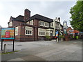
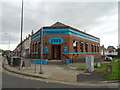
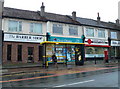
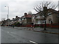
Photos of CH63 8AE
Area Information
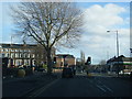
Living in CH63 8AE means being part of a tightly knit residential cluster in the Wirral, where history and modernity intersect. The area spans 597 square metres and is home to 1,514 residents, creating a densely populated yet cohesive community. Its location on the Chester–Birkenhead road has shaped its character, blending rural heritage with accessible urban amenities. The ward of Bebington, which includes CH63 8AE, has roots in Saxon times, with landmarks like the Church of St. Andrew standing as a testament to its past. Today, the area benefits from proximity to rail, ferry, and retail hubs, making it practical for daily life. With a population density of over 2.5 million per square kilometre, the community is compact but offers a mix of historical charm and contemporary convenience. For buyers, this postcode represents a small, defined space where heritage meets modern living, with schools, transport, and amenities within reach.
- Area Type
- Postcode
- Area Size
- 597 m²
- Population
- 1514
- Population Density
- 5017 people/km²
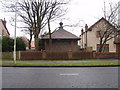
The property market in CH63 8AE is dominated by owner-occupied homes, with 79% of properties in private hands. This high rate of home ownership indicates a stable, long-term resident base, likely comprising families and individuals seeking secure, established housing. The accommodation type is predominantly houses, which is unusual for a small postcode area but suggests a mix of semi-detached and detached properties. This contrasts with areas where flats or apartments dominate, offering a different dynamic for buyers. The compact size of CH63 8AE—just 597 square metres—means the housing stock is limited, potentially increasing competition among buyers. For those considering the area, the focus on owner-occupation implies a market where properties are held for the long term, with fewer rental options. Buyers should also consider the proximity to amenities and transport links, which may enhance the area’s appeal despite its small size.
House Prices in CH63 8AE
Showing 6 properties
| Address | Type | Beds | Baths | Last Sale Price | Last Sale Date | |
|---|---|---|---|---|---|---|
| Apartment 2, The Elms, 15 Ash Road, Higher Bebington, CH63 8AE | Flat | - | - | - | - | |
| Apartment 1, The Elms, 15 Ash Road, Higher Bebington, CH63 8AE | Flat | - | - | - | - | |
| Apartment 4, The Elms, 15 Ash Road, Higher Bebington, CH63 8AE | Flat | 2 | - | - | - | |
| Apartment 3, The Elms, 15 Ash Road, Higher Bebington, CH63 8AE | Flat | - | - | - | - | |
| Apartment 5, The Elms, 15 Ash Road, Higher Bebington, CH63 8AE | Flat | - | - | - | - | |
| Apartment 6, The Elms, 15 Ash Road, Higher Bebington, CH63 8AE | Flat | - | - | - | - |
Energy Efficiency in CH63 8AE
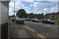
Residents of CH63 8AE enjoy a lifestyle enriched by nearby amenities. The area’s rail network, including Bebington and Port Sunlight stations, offers easy access to urban centres. Retail choices are diverse, with Tesco Birkenhead and Iceland New providing grocery and shopping needs. Ferry terminals at Woodside and Liverpool Pier Head connect the area to Merseyside’s waterways, offering scenic travel options. The presence of five ferry services and five retail outlets within reach ensures convenience for daily errands. While the data does not specify parks or leisure facilities, the proximity to Bebington’s historical sites and the Church of St. Andrew suggests cultural and recreational opportunities. The compact nature of CH63 8AE means amenities are tightly clustered, fostering a sense of community and ease of access.
Amenities
Schools
Residents of CH63 8AE have access to several educational institutions, including St John’s Catholic Junior School and St John’s Catholic Infant School, both rated ‘good’ by Ofsted. These primary schools provide early education with a religious focus, catering to families seeking faith-based schooling. A nearby academy, St John Plessington Catholic College, also rated ‘good’, offers further education options. However, one listed school, St John Plessington Catholic College, lacks an Ofsted rating, which may raise questions about its oversight. The mix of primary and academy schools gives families choices, though the absence of a rating for one institution could be a consideration. For parents, the presence of multiple Catholic schools suggests a community with shared values, while the variety of school types ensures options for different educational preferences.
| Rank | School | Type | Entry gender | Ages |
|---|
Explore more schools in this area
Go to Schools tabDemographics
The population of CH63 8AE is 1,514, with a median age of 47 and the majority of residents aged between 30 and 64. This suggests a community of established adults, many of whom are likely to be homeowners, as 79% of properties are owner-occupied. The predominant accommodation type is houses, indicating a more traditional, family-friendly layout. The predominant ethnic group is White, reflecting the broader demographic trends in the Wirral. The high population density—2.5 million people per square kilometre—raises questions about spatial constraints, though the data does not specify deprivation levels. For residents, this density means a close-knit community with shared resources, but it also underscores the need for efficient use of space. The age profile suggests a stable, mature population, which may influence local services and amenities tailored to older adults and families.
Household Size
Accommodation Type
Tenure
Ethnic Group
Religion
Household Composition
Age
Household Deprivation
NS-SEC
Explore more demographic insights in this area
Go to Demographics tabPlanning
Planning Constraints
- Flood RiskPremium
- Ramsar Wetland SitesPremium
- Area of Outstanding Natural BeautyPremium
- Protected Nature ReservePremium
- Protected WoodlandPremium