Area Overview for CH63 7NR
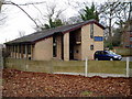
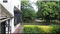
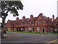
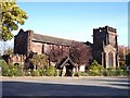
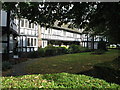
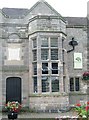
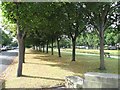
Photos of CH63 7NR


Area Information
Living in CH63 7NR means inhabiting a tightly knit residential cluster in Wirral, England. With a population of 1,555 spread across 1.5 hectares, this area is densely populated, reflecting a compact, community-focused environment. Its strategic location on the Chester–Birkenhead road has historically made it a hub for trade and movement, a legacy still visible in its infrastructure. The area’s demographics suggest a mature population, with a median age of 47 and most residents falling into the 30–64 age bracket. This suggests a stable, long-term community with strong ties to local amenities and traditions. The presence of the Church of St. Andrew, a medieval landmark, and the nearby Bebington Quarry, once a source of sandstone for major buildings, adds historical depth. Despite its small size, CH63 7NR offers proximity to transport networks, retail, and natural connections, blending practicality with a sense of rootedness in a region with Anglo-Saxon roots.
- Area Type
- Postcode
- Area Size
- 1.5 hectares
- Population
- 1555
- Population Density
- 3302 people/km²
The property market in CH63 7NR is characterised by high home ownership (68%) and a predominance of houses. This indicates a largely owner-occupied area, with limited rental activity, suggesting a stable, long-term resident base. The small size of the area—just 1.5 hectares—means the housing stock is limited, making it a niche market for buyers. The focus on houses rather than flats or apartments implies a preference for traditional, family-friendly properties. For buyers, this means competition for available homes, with little scope for new developments. The compact nature of the area also means that proximity to amenities and transport is a key selling point, though the limited land area constrains expansion.
House Prices in CH63 7NR
Showing 45 properties
| Address | Type | Beds | Baths | Last Sale Price | Last Sale Date | |
|---|---|---|---|---|---|---|
| 82 Parkside Road, Bebington, CH63 7NR | Semi-detached | 3 | 1 | £178,000 | Apr 2024 | |
| 24 Parkside Road, Bebington, CH63 7NR | Semi-detached | 3 | 1 | £191,750 | Nov 2021 | |
| 50 Parkside Road, Bebington, CH63 7NR | Semi-detached | 3 | 1 | £154,000 | Dec 2020 | |
| 76 Parkside Road, Bebington, CH63 7NR | house | - | - | £159,995 | Nov 2020 | |
| 42 Parkside Road, Bebington, CH63 7NR | Semi-detached | 3 | - | £122,000 | Apr 2020 | |
| 80 Parkside Road, Bebington, CH63 7NR | Terraced | 3 | 1 | £159,995 | Jan 2020 | |
| 60 Parkside Road, Bebington, CH63 7NR | Terraced | 3 | 1 | £143,500 | Oct 2018 | |
| 20 Parkside Road, Bebington, CH63 7NR | house | - | 3 | £123,000 | Feb 2018 | |
| 66 Parkside Road, Bebington, CH63 7NR | Semi-detached | 3 | - | £155,000 | Jan 2018 | |
| 78 Parkside Road, Bebington, CH63 7NR | Semi-detached | 3 | 1 | £120,000 | Sep 2017 |
Energy Efficiency in CH63 7NR
The lifestyle in CH63 7NR is shaped by its proximity to retail, transport, and historical sites. Residents can access Aldi, Iceland, and Heron New for daily shopping, while rail stations like Bebington and Spital provide links to regional hubs. The area’s connection to ferry terminals offers easy access to Liverpool and Birkenhead, supporting both leisure and commuting. The Church of St. Andrew, a medieval site, and the conservation area heritage trail add cultural and historical depth to daily life. The compact nature of the area means amenities are within walking or short driving distance, fostering a convenient, community-oriented lifestyle. While green spaces are limited, the area’s historical character and transport links compensate, offering a blend of practicality and heritage.
Amenities
Schools
The nearest school to CH63 7NR is St Andrew’s CofE Aided Primary School, which has an Ofsted rating of outstanding. This school serves the primary education needs of the area, offering a high standard of teaching and facilities. As a primary school, it caters to children aged 4–11, making it a critical resource for families with young children. The absence of secondary schools in the immediate vicinity means parents may need to look further afield for secondary education, though the area’s connectivity to rail and ferry services could ease this challenge. The presence of an outstanding primary school is a significant draw for families prioritising quality education, though the lack of a broader range of school types may require planning for older children.
| Rank | School | Type | Entry gender | Ages |
|---|
Explore more schools in this area
Go to Schools tabDemographics
The community in CH63 7NR is predominantly composed of adults aged 30–64, with a median age of 47. This suggests a population largely settled in careers and family life, contributing to a stable, low-turnover environment. Home ownership is high at 68%, indicating a strong presence of long-term residents. The accommodation type is primarily houses, which aligns with the area’s residential character. The predominant ethnic group is White, reflecting a homogenous demographic profile. The population density of 104,545 people per square kilometre highlights the compact nature of the area, where proximity to neighbours is a defining feature. This density, combined with the age profile, suggests a community focused on local connections and established routines, with limited turnover of residents.
Household Size
Accommodation Type
Tenure
Ethnic Group
Religion
Household Composition
Age
Household Deprivation
NS-SEC
Explore more demographic insights in this area
Go to Demographics tabPlanning
Planning Constraints
- Flood RiskPremium
- Ramsar Wetland SitesPremium
- Area of Outstanding Natural BeautyPremium
- Protected Nature ReservePremium
- Protected WoodlandPremium