Area Overview for CH63 6AA
Photos of CH63 6AA
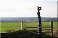
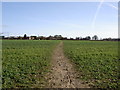
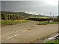
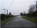
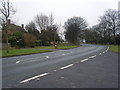
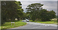
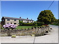
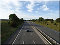
35 photos from this area
Area Information
Key information about the CH63 6AA including its size, population, and administrative classification.
- Area Type
- Postcode
- Area Size
- 8.5 hectares
- Population
- 1596
- Population Density
- 263 people/km²
House Prices in CH63 6AA
31
Properties
£467,040
Average Sold Price
£319,950
Lowest Price
£749,950
Highest Price
Showing 31 properties
| Address | Type | Beds | Baths | Last Sale Price | Last Sale Date | |
|---|---|---|---|---|---|---|
| 27 Jane Grove, Storeton, CH63 6AA | house | - | - | £550,000 | Aug 2025 | |
| 26 Jane Grove, Storeton, CH63 6AA | Detached | 4 | 4 | £485,000 | Aug 2025 | |
| 4 Jane Grove, Storeton, CH63 6AA | house | - | - | £360,000 | Nov 2022 | |
| 22 Jane Grove, Storeton, CH63 6AA | house | - | - | £479,950 | Sep 2022 | |
| 23 Jane Grove, Storeton, CH63 6AA | house | 4 | 4 | £544,950 | Sep 2022 | |
| 21 Jane Grove, Storeton, CH63 6AA | house | - | - | £499,950 | Feb 2022 | |
| 25 Jane Grove, Storeton, CH63 6AA | house | - | - | £439,950 | Dec 2021 | |
| 17 Jane Grove, Storeton, CH63 6AA | house | - | - | £749,950 | Oct 2021 | |
| 28 Jane Grove, Storeton, CH63 6AA | house | 6 | 4 | £699,950 | Sep 2021 | |
| 20 Jane Grove, Storeton, CH63 6AA | house | - | - | £384,950 | Aug 2021 |
Page 1 of 4
Energy Efficiency in CH63 6AA
Amenities
Schools
| Rank | School | Type | Entry gender | Ages |
|---|
Explore more schools in this area
Go to Schools tabDemographics
Household Size
Two person
most common
Accommodation Type
Houses
most common
Tenure
83
majority
Ethnic Group
White
most common
Religion
N/A
most common
Household Composition
N/A
most common
Age
47
median
Adults (30-64 years)
most common
Household Deprivation
N/A
with no deprivation
NS-SEC
42
in Lower managerial occupations
Explore more demographic insights in this area
Go to Demographics tabPlanning
Planning Constraints
- Flood RiskPremium
- Ramsar Wetland SitesPremium
- Area of Outstanding Natural BeautyPremium
- Protected Nature ReservePremium
- Protected WoodlandPremium