Area Overview for CH63 2HT
Photos of CH63 2HT


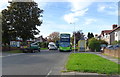
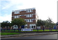
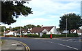
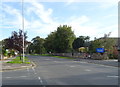
14 photos from this area
Area Information
Key information about the CH63 2HT including its size, population, and administrative classification.
- Area Type
- Postcode
- Area Size
- 1.2 hectares
- Population
- 1590
- Population Density
- 3136 people/km²
House Prices in CH63 2HT
35
Properties
£220,356
Average Sold Price
£76,000
Lowest Price
£320,000
Highest Price
Showing 35 properties
| Address | Type | Beds | Baths | Last Sale Price | Last Sale Date | |
|---|---|---|---|---|---|---|
| 25 Tudorville Road, Bebington, CH63 2HT | Semi-detached | 4 | 1 | £297,000 | Sep 2025 | |
| 15 Tudorville Road, Bebington, CH63 2HT | house | - | - | £282,000 | Feb 2025 | |
| 27 Tudorville Road, Bebington, CH63 2HT | house | - | - | £275,000 | Dec 2022 | |
| 5 Tudorville Road, Bebington, CH63 2HT | house | - | - | £320,000 | Jun 2022 | |
| 47 Tudorville Road, Bebington, CH63 2HT | house | - | - | £271,000 | Sep 2021 | |
| 21 Tudorville Road, Bebington, CH63 2HT | Semi-detached | 3 | 1 | £240,000 | Feb 2021 | |
| 57 Tudorville Road, Bebington, CH63 2HT | house | - | - | £251,000 | Nov 2020 | |
| 61 Tudorville Road, Bebington, CH63 2HT | Semi-detached | 3 | 1 | £200,000 | Sep 2018 | |
| 51 Tudorville Road, Bebington, CH63 2HT | Semi-detached | 3 | 1 | £232,000 | Sep 2018 | |
| 1A Tudorville Road, Bebington, CH63 2HT | Semi-detached | 3 | - | £182,000 | Dec 2017 |
Page 1 of 4
Energy Efficiency in CH63 2HT
Amenities
Schools
| Rank | School | Type | Entry gender | Ages |
|---|
Explore more schools in this area
Go to Schools tabDemographics
Household Size
One person
most common
Accommodation Type
Houses
most common
Tenure
62
majority
Ethnic Group
White
most common
Religion
N/A
most common
Household Composition
N/A
most common
Age
47
median
Adults (30-64 years)
most common
Household Deprivation
N/A
with no deprivation
NS-SEC
36
in Lower managerial occupations
Explore more demographic insights in this area
Go to Demographics tabPlanning
Planning Constraints
- Flood RiskPremium
- Ramsar Wetland SitesPremium
- Area of Outstanding Natural BeautyPremium
- Protected Nature ReservePremium
- Protected WoodlandPremium