Area Overview for CH63 0EN
Photos of CH63 0EN
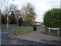
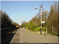
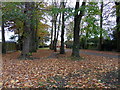
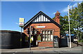
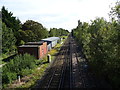
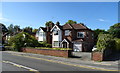
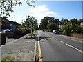
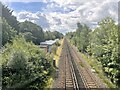
11 photos from this area
Area Information
Key information about the CH63 0EN including its size, population, and administrative classification.
- Area Type
- Postcode
- Area Size
- 6215 m²
- Population
- 1340
- Population Density
- 2064 people/km²
House Prices in CH63 0EN
13
Properties
£225,950
Average Sold Price
£89,000
Lowest Price
£310,000
Highest Price
Showing 13 properties
| Address | Type | Beds | Baths | Last Sale Price | Last Sale Date | |
|---|---|---|---|---|---|---|
| 97 Brookhurst Road, Bromborough, CH63 0EN | house | - | - | £305,000 | Jul 2020 | |
| 99 Brookhurst Road, Bromborough, CH63 0EN | Detached | 4 | 1 | £310,000 | Mar 2020 | |
| 109 Brookhurst Road, Bromborough, CH63 0EN | house | - | - | £295,000 | Jan 2020 | |
| 111 Brookhurst Road, Bromborough, CH63 0EN | Detached | 3 | - | £289,995 | Nov 2017 | |
| 101 Brookhurst Road, Bromborough, CH63 0EN | house | - | - | £255,000 | Oct 2017 | |
| 93 Brookhurst Road, Bromborough, CH63 0EN | Detached | 3 | 1 | £227,500 | Apr 2014 | |
| 91 Brookhurst Road, Bromborough, CH63 0EN | Detached | 4 | 3 | £230,000 | Jul 2009 | |
| 105 Brookhurst Road, Bromborough, CH63 0EN | Detached | - | - | £230,000 | Feb 2006 | |
| 89 Brookhurst Road, Bromborough, CH63 0EN | Detached | 3 | - | £153,950 | Aug 2002 | |
| 107 Brookhurst Road, Bromborough, CH63 0EN | Detached | - | - | £89,000 | Dec 1996 |
Page 1 of 2
Energy Efficiency in CH63 0EN
Amenities
Schools
| Rank | School | Type | Entry gender | Ages |
|---|
Explore more schools in this area
Go to Schools tabDemographics
Household Size
Two person
most common
Accommodation Type
Houses
most common
Tenure
93
majority
Ethnic Group
White
most common
Religion
N/A
most common
Household Composition
N/A
most common
Age
47
median
Adults (30-64 years)
most common
Household Deprivation
N/A
with no deprivation
NS-SEC
41
in Lower managerial occupations
Explore more demographic insights in this area
Go to Demographics tabPlanning
Planning Constraints
- Flood RiskPremium
- Ramsar Wetland SitesPremium
- Area of Outstanding Natural BeautyPremium
- Protected Nature ReservePremium
- Protected WoodlandPremium