Area Overview for CH62 8EQ
Photos of CH62 8EQ

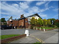
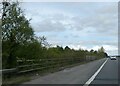
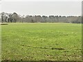


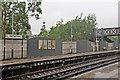
20 photos from this area
Area Information
Key information about the CH62 8EQ including its size, population, and administrative classification.
- Area Type
- Postcode
- Area Size
- 1.2 hectares
- Population
- 1207
- Population Density
- 4538 people/km²
House Prices in CH62 8EQ
29
Properties
£154,281
Average Sold Price
£40,000
Lowest Price
£282,000
Highest Price
Showing 29 properties
| Address | Type | Beds | Baths | Last Sale Price | Last Sale Date | |
|---|---|---|---|---|---|---|
| 203 Sutherland Drive, Eastham, CH62 8EQ | Bungalow | 3 | 1 | £282,000 | Oct 2025 | |
| 207 Sutherland Drive, Eastham, CH62 8EQ | house | - | - | £190,000 | Sep 2024 | |
| 217 Sutherland Drive, Eastham, CH62 8EQ | Terraced | 4 | 1 | £200,000 | Aug 2024 | |
| 191 Sutherland Drive, Eastham, CH62 8EQ | Semi-detached | 3 | 1 | £211,000 | Jun 2024 | |
| 241 Sutherland Drive, Eastham, CH62 8EQ | Semi-detached | 3 | 1 | £166,000 | Jan 2024 | |
| 235 Sutherland Drive, Eastham, CH62 8EQ | house | - | - | £189,000 | Jun 2023 | |
| 187 Sutherland Drive, Eastham, CH62 8EQ | Semi-detached | 3 | 1 | £116,000 | Dec 2021 | |
| 231 Sutherland Drive, Eastham, CH62 8EQ | Bungalow | - | - | £149,500 | Sep 2020 | |
| 225 Sutherland Drive, Eastham, CH62 8EQ | Bungalow | - | - | £150,000 | Jun 2020 | |
| 215 Sutherland Drive, Eastham, CH62 8EQ | Terraced | 4 | 2 | £220,000 | Aug 2018 |
Page 1 of 3
Energy Efficiency in CH62 8EQ
Amenities
Schools
| Rank | School | Type | Entry gender | Ages |
|---|
Explore more schools in this area
Go to Schools tabDemographics
Household Size
Two person
most common
Accommodation Type
Houses
most common
Tenure
91
majority
Ethnic Group
White
most common
Religion
N/A
most common
Household Composition
N/A
most common
Age
47
median
Adults (30-64 years)
most common
Household Deprivation
N/A
with no deprivation
NS-SEC
33
in Lower managerial occupations
Explore more demographic insights in this area
Go to Demographics tabPlanning
Planning Constraints
- Flood RiskPremium
- Ramsar Wetland SitesPremium
- Area of Outstanding Natural BeautyPremium
- Protected Nature ReservePremium
- Protected WoodlandPremium