Area Overview for CH62 3QH
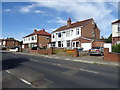
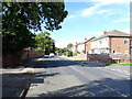
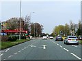
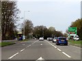
Photos of CH62 3QH

Area Information
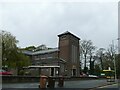
Living in CH62 3QH means being part of a small, tightly knit residential cluster in the Wirral Peninsula, England. The postcode covers a compact area with a population of 1,563, translating to a high density of 1,016 people per square kilometre. Situated within Bromborough Ward, this area blends historical roots with modern convenience. Bromborough itself, a village with Anglo-Saxon origins, is known for its 13th-century steps at Bromborough Cross and proximity to the River Mersey. Daily life here is shaped by its proximity to rail networks, ferry services, and nearby towns like New Ferry and Birkenhead. The area’s compact size means amenities are within practical reach, while its location offers easy access to Liverpool via ferry and rail. With a median age of 47 and a strong home-ownership culture, the community reflects a stable, mature demographic. This is a place where historical legacy meets contemporary living, with a focus on family-oriented environments and accessible transport links.
- Area Type
- Postcode
- Area Size
- Not available
- Population
- 1563
- Population Density
- 1016 people/km²
CH62 3QH is predominantly a home-ownership area, with 85% of properties owned by residents rather than rented. The accommodation type is primarily houses, which is uncommon in many urban areas but typical of smaller, suburban or rural clusters. This suggests a focus on family homes and long-term residency rather than a rental market. The high home-ownership rate indicates a community with strong ties to the area, likely contributing to a sense of continuity and local identity. However, the small size of the postcode area—covering a limited number of properties—means the housing stock is constrained. Buyers should consider proximity to nearby towns like New Ferry or Birkenhead for additional options. The presence of houses rather than flats may appeal to those seeking larger living spaces or gardens, though the area’s compact nature limits expansion.
House Prices in CH62 3QH
No properties found in this postcode.
Energy Efficiency in CH62 3QH
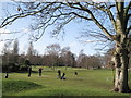
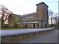
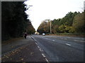
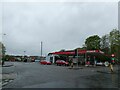
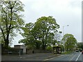
Residents of CH62 3QH have access to a range of amenities within practical reach. Retail options include Morrisons Daily and two Co-op stores in Bromborough, ensuring everyday shopping needs are met. Rail stations like Bromborough Rake and Spital connect to broader transport networks, while ferry terminals at Woodside Birkenhead and Liverpool Pier Head provide links to Liverpool. The proximity to Liverpool John Lennon Airport adds to the area’s accessibility. The presence of multiple retail outlets, combined with transport links, creates a convenient lifestyle. The area’s small size means amenities are tightly clustered, reducing travel time. For leisure, the River Mersey and nearby parks like Brotherton Park (part of Dibbinsdale Nature Reserve) offer green spaces. This mix of retail, transport, and natural surroundings supports a balanced, accessible lifestyle.
Amenities
Schools
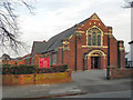
The schools nearest to CH62 3QH include Woodslee Primary School, a primary institution, and Co-op Academy Woodslee, an academy with a good Ofsted rating. These two schools cater to different educational stages, providing a continuum of schooling for families. The presence of a primary school ensures immediate access to early education, while the academy offers secondary-level education with a recognised standard of teaching. The good Ofsted rating for Co-op Academy Woodslee suggests a reliable, well-performing institution. This mix of school types supports families seeking both foundational and advanced education without needing to travel far. The proximity of these schools to residential areas in CH62 3QH enhances the area’s appeal for households prioritising quality education for their children.
| Rank | School | Type | Entry gender | Ages |
|---|
Explore more schools in this area
Go to Schools tabDemographics
The population of CH62 3QH is 1,563, with a median age of 47. The most common age range is adults aged 30–64, reflecting a mature, established community. Home ownership is high at 85%, indicating a strong presence of long-term residents. The area is predominantly composed of houses, with no data suggesting flats or other property types. The predominant ethnic group is White, with no specific figures provided for other groups. The high home-ownership rate and age profile suggest a stable, low-turnover community. The population density of 1,016 people per square kilometre implies a compact, residential layout, likely centred around Bromborough’s historic core. This demographic profile aligns with a place where families and professionals seeking stability are likely to reside, with limited transient populations.
Household Size
Accommodation Type
Tenure
Ethnic Group
Religion
Household Composition
Age
Household Deprivation
NS-SEC
Explore more demographic insights in this area
Go to Demographics tabPlanning
Planning Constraints
- Flood RiskPremium
- Ramsar Wetland SitesPremium
- Area of Outstanding Natural BeautyPremium
- Protected Nature ReservePremium
- Protected WoodlandPremium