Area Overview for CH62 1EJ
Photos of CH62 1EJ
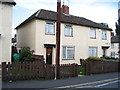
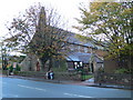

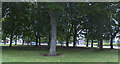
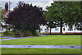
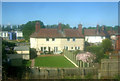


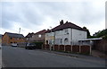
39 photos from this area
Area Information
Key information about the CH62 1EJ including its size, population, and administrative classification.
- Area Type
- Postcode
- Area Size
- 6592 m²
- Population
- 1609
- Population Density
- 4949 people/km²
House Prices in CH62 1EJ
32
Properties
£69,998
Average Sold Price
£18,000
Lowest Price
£115,000
Highest Price
Showing 32 properties
| Address | Type | Beds | Baths | Last Sale Price | Last Sale Date | |
|---|---|---|---|---|---|---|
| 13 Onslow Road, New Ferry, CH62 1EJ | Terraced | 3 | 1 | £76,000 | May 2024 | |
| 34 Onslow Road, New Ferry, CH62 1EJ | Terraced | 3 | 1 | £105,000 | Oct 2023 | |
| 6 Onslow Road, New Ferry, CH62 1EJ | Terraced | 2 | 1 | £100,000 | Sep 2023 | |
| 21 Onslow Road, New Ferry, CH62 1EJ | Terraced | 3 | - | £80,000 | Mar 2022 | |
| 20 Onslow Road, New Ferry, CH62 1EJ | Terraced | 3 | 1 | £102,500 | Feb 2022 | |
| 32 Onslow Road, New Ferry, CH62 1EJ | Terraced | 3 | 1 | £90,000 | Jan 2022 | |
| 23 Onslow Road, New Ferry, CH62 1EJ | Terraced | 3 | 1 | £115,000 | Sep 2021 | |
| 36 Onslow Road, New Ferry, CH62 1EJ | Terraced | 3 | 1 | £82,000 | Dec 2018 | |
| 19 Onslow Road, New Ferry, CH62 1EJ | house | 3 | 1 | £75,500 | May 2017 | |
| 3 Onslow Road, New Ferry, CH62 1EJ | Terraced | 3 | - | £57,500 | Mar 2016 |
Page 1 of 4
Energy Efficiency in CH62 1EJ
Amenities
Schools
| Rank | School | Type | Entry gender | Ages |
|---|
Explore more schools in this area
Go to Schools tabDemographics
Household Size
One person
most common
Accommodation Type
Houses
most common
Tenure
55
majority
Ethnic Group
White
most common
Religion
N/A
most common
Household Composition
N/A
most common
Age
47
median
Adults (30-64 years)
most common
Household Deprivation
N/A
with no deprivation
NS-SEC
23
in Lower managerial occupations
Explore more demographic insights in this area
Go to Demographics tabPlanning
Planning Constraints
- Flood RiskPremium
- Ramsar Wetland SitesPremium
- Area of Outstanding Natural BeautyPremium
- Protected Nature ReservePremium
- Protected WoodlandPremium