Area Overview for CH61 6UY
Photos of CH61 6UY
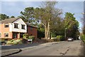
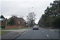
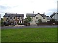
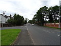
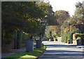
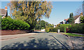
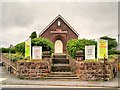
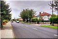
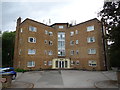
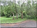
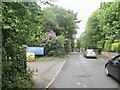
15 photos from this area
Area Information
Key information about the CH61 6UY including its size, population, and administrative classification.
- Area Type
- Postcode
- Area Size
- 1.1 hectares
- Population
- Not available
- Population Density
- Not available
House Prices in CH61 6UY
19
Properties
£221,573
Average Sold Price
£62,000
Lowest Price
£400,000
Highest Price
Showing 19 properties
| Address | Type | Beds | Baths | Last Sale Price | Last Sale Date | |
|---|---|---|---|---|---|---|
| 67 Irby Road, Heswall, CH61 6UY | house | 2 | 1 | £120,000 | Apr 2025 | |
| 47 Irby Road, Heswall, CH61 6UY | Semi-detached | 3 | - | £290,000 | Jan 2021 | |
| 49 Irby Road, Heswall, CH61 6UY | house | - | - | £240,000 | Oct 2018 | |
| 65 Irby Road, Heswall, CH61 6UY | Bungalow | 3 | - | £325,000 | Dec 2017 | |
| 45 Irby Road, Heswall, CH61 6UY | Semi-detached | 3 | 1 | £255,000 | Jul 2017 | |
| Laburnum Cottage, 69 Irby Road, Heswall, CH61 6UY | Semi-detached | 2 | - | £125,000 | Oct 2015 | |
| 51 Irby Road, Heswall, CH61 6UY | house | - | - | £154,950 | Mar 2013 | |
| 61 Irby Road, Heswall, CH61 6UY | Bungalow | - | - | £250,000 | Apr 2010 | |
| 73 Irby Road, Heswall, CH61 6UY | Detached | - | - | £400,000 | Jul 2008 | |
| 63 Irby Road, Heswall, CH61 6UY | Detached | - | - | £308,500 | Jul 2006 |
Page 1 of 2
Energy Efficiency in CH61 6UY
Amenities
Schools
| Rank | School | Type | Entry gender | Ages |
|---|
Explore more schools in this area
Go to Schools tabDemographics
Household Size
One person
most common
Accommodation Type
Houses
most common
Tenure
80
majority
Ethnic Group
White
most common
Religion
N/A
most common
Household Composition
N/A
most common
Age
47
median
Adults (30-64 years)
most common
Household Deprivation
N/A
with no deprivation
NS-SEC
44
in Lower managerial occupations
Explore more demographic insights in this area
Go to Demographics tabPlanning
Planning Constraints
- Flood RiskPremium
- Ramsar Wetland SitesPremium
- Area of Outstanding Natural BeautyPremium
- Protected Nature ReservePremium
- Protected WoodlandPremium