Area Overview for CH61 5UU
Photos of CH61 5UU
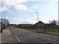
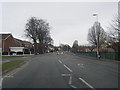
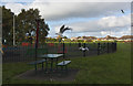
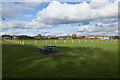
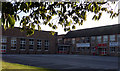
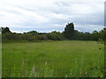
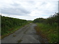

8 photos from this area
Area Information
Key information about the CH61 5UU including its size, population, and administrative classification.
- Area Type
- Postcode
- Area Size
- 6912 m²
- Population
- 1638
- Population Density
- 2784 people/km²
House Prices in CH61 5UU
19
Properties
£144,708
Average Sold Price
£53,500
Lowest Price
£252,500
Highest Price
Showing 19 properties
| Address | Type | Beds | Baths | Last Sale Price | Last Sale Date | |
|---|---|---|---|---|---|---|
| 8 Old Meadow Road, Pensby, CH61 5UU | Semi-detached | 3 | 1 | £205,000 | Jun 2023 | |
| 3 Old Meadow Road, Pensby, CH61 5UU | house | - | - | £190,000 | May 2022 | |
| 1 Old Meadow Road, Pensby, CH61 5UU | Semi-detached | 3 | 1 | £120,000 | Jun 2019 | |
| 4 Old Meadow Road, Pensby, CH61 5UU | Semi-detached | 3 | 1 | £178,000 | Apr 2019 | |
| 5 Old Meadow Road, Pensby, CH61 5UU | house | - | - | £140,000 | Jul 2017 | |
| 10 Old Meadow Road, Pensby, CH61 5UU | Semi-detached | 5 | - | £192,000 | Dec 2016 | |
| 8A Old Meadow Road, Pensby, CH61 5UU | Detached | 4 | - | £252,500 | Nov 2016 | |
| 17 Old Meadow Road, Pensby, CH61 5UU | Semi-detached | 4 | - | £157,000 | Aug 2014 | |
| 9 Old Meadow Road, Pensby, CH61 5UU | house | - | - | £118,000 | Aug 2013 | |
| 2 Old Meadow Road, Pensby, CH61 5UU | Semi-detached | - | - | £72,000 | Mar 2002 |
Page 1 of 2
Energy Efficiency in CH61 5UU
Amenities
Schools
| Rank | School | Type | Entry gender | Ages |
|---|
Explore more schools in this area
Go to Schools tabDemographics
Household Size
Two person
most common
Accommodation Type
Houses
most common
Tenure
70
majority
Ethnic Group
White
most common
Religion
N/A
most common
Household Composition
N/A
most common
Age
47
median
Adults (30-64 years)
most common
Household Deprivation
N/A
with no deprivation
NS-SEC
29
in Lower managerial occupations
Explore more demographic insights in this area
Go to Demographics tabPlanning
Planning Constraints
- Flood RiskPremium
- Ramsar Wetland SitesPremium
- Area of Outstanding Natural BeautyPremium
- Protected Nature ReservePremium
- Protected WoodlandPremium