Area Overview for CH61 4UX
Photos of CH61 4UX
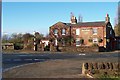
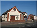
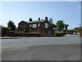
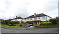
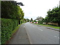
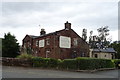
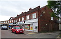
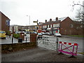
27 photos from this area
Area Information
Key information about the CH61 4UX including its size, population, and administrative classification.
- Area Type
- Postcode
- Area Size
- 2.5 hectares
- Population
- 1693
- Population Density
- 1024 people/km²
House Prices in CH61 4UX
38
Properties
£229,354
Average Sold Price
£60,000
Lowest Price
£570,000
Highest Price
Showing 38 properties
| Address | Type | Beds | Baths | Last Sale Price | Last Sale Date | |
|---|---|---|---|---|---|---|
| 21 Seaview Avenue, Irby, CH61 4UX | Bungalow | - | - | £417,500 | Apr 2025 | |
| 23 Seaview Avenue, Irby, CH61 4UX | Semi-detached | 3 | 1 | £395,000 | Dec 2023 | |
| 3 Seaview Avenue, Irby, CH61 4UX | house | - | - | £570,000 | Jun 2022 | |
| 15 Seaview Avenue, Irby, CH61 4UX | house | - | - | £425,000 | Jan 2021 | |
| 2B Seaview Avenue, Irby, CH61 4UX | Bungalow | - | - | £305,000 | Dec 2020 | |
| 31 Seaview Avenue, Irby, CH61 4UX | Bungalow | - | - | £265,000 | Dec 2019 | |
| 9 Seaview Avenue, Irby, CH61 4UX | Semi-detached | 4 | 2 | £315,000 | Oct 2017 | |
| 6 Seaview Avenue, Irby, CH61 4UX | Bungalow | - | - | £315,000 | Aug 2017 | |
| 33 Seaview Avenue, Irby, CH61 4UX | Semi-detached | 2 | - | £189,000 | Aug 2017 | |
| 22A Seaview Avenue, Irby, CH61 4UX | Semi-detached | 2 | - | £238,000 | Feb 2016 |
Page 1 of 4
Energy Efficiency in CH61 4UX
Amenities
Schools
| Rank | School | Type | Entry gender | Ages |
|---|
Explore more schools in this area
Go to Schools tabDemographics
Household Size
Two person
most common
Accommodation Type
Houses
most common
Tenure
86
majority
Ethnic Group
White
most common
Religion
N/A
most common
Household Composition
N/A
most common
Age
47
median
Adults (30-64 years)
most common
Household Deprivation
N/A
with no deprivation
NS-SEC
42
in Lower managerial occupations
Explore more demographic insights in this area
Go to Demographics tabPlanning
Planning Constraints
- Flood RiskPremium
- Ramsar Wetland SitesPremium
- Area of Outstanding Natural BeautyPremium
- Protected Nature ReservePremium
- Protected WoodlandPremium