Area Overview for CH61 3UR
Photos of CH61 3UR

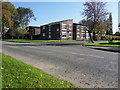
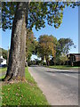
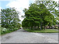

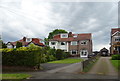


13 photos from this area
Area Information
Key information about the CH61 3UR including its size, population, and administrative classification.
- Area Type
- Postcode
- Area Size
- 5378 m²
- Population
- 1450
- Population Density
- 2534 people/km²
House Prices in CH61 3UR
10
Properties
£299,906
Average Sold Price
£171,000
Lowest Price
£450,000
Highest Price
Showing 10 properties
| Address | Type | Beds | Baths | Last Sale Price | Last Sale Date | |
|---|---|---|---|---|---|---|
| 6 Menlo Avenue, Irby, CH61 3UR | Semi-detached | 4 | 1 | £450,000 | Mar 2022 | |
| 5 Menlo Avenue, Irby, CH61 3UR | house | - | - | £326,000 | Mar 2021 | |
| 7 Menlo Avenue, Irby, CH61 3UR | Semi-detached | 3 | 2 | £295,000 | Jul 2019 | |
| 4 Menlo Avenue, Irby, CH61 3UR | Semi-detached | 4 | - | £350,000 | May 2019 | |
| 2 Menlo Avenue, Irby, CH61 3UR | house | - | - | £320,000 | Nov 2014 | |
| 8 Menlo Avenue, Irby, CH61 3UR | Semi-detached | - | - | £237,250 | Jul 2012 | |
| 9 Menlo Avenue, Irby, CH61 3UR | Semi-detached | - | - | £249,995 | Aug 2005 | |
| 3 Menlo Avenue, Irby, CH61 3UR | Semi-detached | - | - | £171,000 | Jul 2003 | |
| 1 Menlo Avenue, Irby, CH61 3UR | house | - | - | - | - | |
| Roche, 10 Menlo Avenue, Irby, CH61 3UR | Semi-detached | - | - | - | - |
Energy Efficiency in CH61 3UR
Amenities
Schools
| Rank | School | Type | Entry gender | Ages |
|---|
Explore more schools in this area
Go to Schools tabDemographics
Household Size
Two person
most common
Accommodation Type
Houses
most common
Tenure
78
majority
Ethnic Group
White
most common
Religion
N/A
most common
Household Composition
N/A
most common
Age
47
median
Adults (30-64 years)
most common
Household Deprivation
N/A
with no deprivation
NS-SEC
37
in Lower managerial occupations
Explore more demographic insights in this area
Go to Demographics tabPlanning
Planning Constraints
- Flood RiskPremium
- Ramsar Wetland SitesPremium
- Area of Outstanding Natural BeautyPremium
- Protected Nature ReservePremium
- Protected WoodlandPremium