Area Overview for CH61 0HF
Photos of CH61 0HF
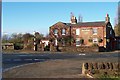
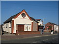
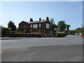
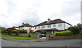
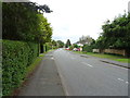
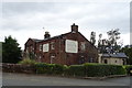
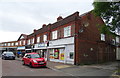
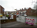
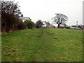
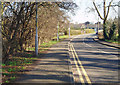
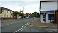
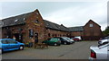
27 photos from this area
Area Information
Key information about the CH61 0HF including its size, population, and administrative classification.
- Area Type
- Postcode
- Area Size
- 4.7 hectares
- Population
- 1633
- Population Density
- 333 people/km²
House Prices in CH61 0HF
20
Properties
£338,364
Average Sold Price
£64,000
Lowest Price
£580,000
Highest Price
Showing 20 properties
| Address | Type | Beds | Baths | Last Sale Price | Last Sale Date | |
|---|---|---|---|---|---|---|
| Melwood House, 48 Thurstaston Road, Irby, CH61 0HF | Detached | 4 | 2 | £520,000 | Nov 2023 | |
| 40 Thurstaston Road, Irby, CH61 0HF | house | - | - | £580,000 | Nov 2020 | |
| 33 Thurstaston Road, Irby, CH61 0HF | Detached | 3 | - | £375,000 | Jul 2020 | |
| Thornton, 34 Thurstaston Road, Irby, CH61 0HF | house | - | - | £435,000 | Aug 2019 | |
| Greenheys Nursery, 41 Thurstaston Road, Irby, CH61 0HF | Land | - | - | £400,000 | Jan 2017 | |
| South View, 30 Thurstaston Road, Irby, CH61 0HF | house | - | - | £297,000 | Jun 2014 | |
| Thorn Hey, 51 Thurstaston Road, Irby, CH61 0HF | house | - | - | £425,000 | Aug 2010 | |
| 38 Thurstaston Road, Irby, CH61 0HF | Detached | - | - | £375,000 | Jan 2004 | |
| 28 Thurstaston Road, Irby, CH61 0HF | house | - | - | £64,000 | Oct 1996 | |
| 50 Thurstaston Road, Irby, CH61 0HF | Detached | - | - | £185,000 | Mar 1996 |
Page 1 of 2
Energy Efficiency in CH61 0HF
Amenities
Schools
| Rank | School | Type | Entry gender | Ages |
|---|
Explore more schools in this area
Go to Schools tabDemographics
Household Size
Two person
most common
Accommodation Type
Houses
most common
Tenure
93
majority
Ethnic Group
White
most common
Religion
N/A
most common
Household Composition
N/A
most common
Age
47
median
Adults (30-64 years)
most common
Household Deprivation
N/A
with no deprivation
NS-SEC
51
in Lower managerial occupations
Explore more demographic insights in this area
Go to Demographics tabPlanning
Planning Constraints
- Flood RiskPremium
- Ramsar Wetland SitesPremium
- Area of Outstanding Natural BeautyPremium
- Protected Nature ReservePremium
- Protected WoodlandPremium