Area Overview for CH60 9HZ
Photos of CH60 9HZ
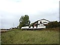
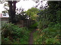
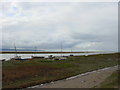
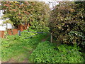
34 photos from this area
Area Information
Key information about the CH60 9HZ including its size, population, and administrative classification.
- Area Type
- Postcode
- Area Size
- 9930 m²
- Population
- 1454
- Population Density
- 475 people/km²
House Prices in CH60 9HZ
8
Properties
£542,857
Average Sold Price
£400,000
Lowest Price
£760,000
Highest Price
Showing 8 properties
| Address | Type | Beds | Baths | Last Sale Price | Last Sale Date | |
|---|---|---|---|---|---|---|
| 27 Pipers Lane, Heswall, CH60 9HZ | Detached | 4 | 3 | £615,000 | Oct 2018 | |
| Sunridge, 23 Pipers Lane, Heswall, CH60 9HZ | Detached | 4 | 2 | £620,000 | May 2015 | |
| 37 Pipers Lane, Heswall, CH60 9HZ | Detached | - | - | £435,000 | Jun 2012 | |
| 33 Pipers Lane, Heswall, CH60 9HZ | house | - | - | £400,000 | May 2012 | |
| Valleyfield, 31 Pipers Lane, Heswall, CH60 9HZ | house | - | - | £520,000 | Nov 2011 | |
| 25 Pipers Lane, Heswall, CH60 9HZ | Bungalow | - | - | £450,000 | Aug 2009 | |
| Holly House, 29 Pipers Lane, Heswall, CH60 9HZ | Detached | - | - | £760,000 | Aug 2007 | |
| 35 Pipers Lane, Heswall, CH60 9HZ | Bungalow | 3 | 1 | - | - |
Energy Efficiency in CH60 9HZ
Amenities
Schools
| Rank | School | Type | Entry gender | Ages |
|---|
Explore more schools in this area
Go to Schools tabDemographics
Household Size
Two person
most common
Accommodation Type
Houses
most common
Tenure
96
majority
Ethnic Group
White
most common
Religion
N/A
most common
Household Composition
N/A
most common
Age
47
median
Adults (30-64 years)
most common
Household Deprivation
N/A
with no deprivation
NS-SEC
56
in Lower managerial occupations
Explore more demographic insights in this area
Go to Demographics tabPlanning
Planning Constraints
- Flood RiskPremium
- Ramsar Wetland SitesPremium
- Area of Outstanding Natural BeautyPremium
- Protected Nature ReservePremium
- Protected WoodlandPremium