Area Overview for CH60 7TB
Photos of CH60 7TB
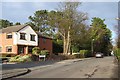
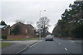
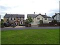
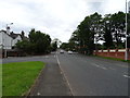
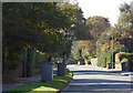
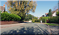
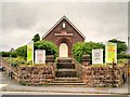
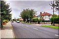
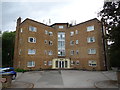
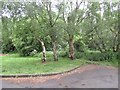
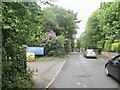
15 photos from this area
Area Information
Key information about the CH60 7TB including its size, population, and administrative classification.
- Area Type
- Postcode
- Area Size
- 8438 m²
- Population
- Not available
- Population Density
- Not available
House Prices in CH60 7TB
39
Properties
£151,931
Average Sold Price
£38,000
Lowest Price
£249,950
Highest Price
Showing 39 properties
| Address | Type | Beds | Baths | Last Sale Price | Last Sale Date | |
|---|---|---|---|---|---|---|
| 18 Grange Mount, Heswall, CH60 7TB | Terraced | 2 | 1 | £231,000 | Mar 2024 | |
| Grange Cottage, 7 Grange Mount, Heswall, CH60 7TB | Terraced | 2 | 1 | £195,000 | Jun 2023 | |
| 28 Grange Mount, Heswall, CH60 7TB | house | - | - | £249,950 | Aug 2022 | |
| 12 Grange Mount, Heswall, CH60 7TB | Terraced | 2 | 1 | £222,000 | Oct 2021 | |
| 2 Grange Mount, Heswall, CH60 7TB | Terraced | 2 | 1 | £175,000 | Sep 2021 | |
| 9 Grange Mount, Heswall, CH60 7TB | Terraced | 2 | 1 | £152,000 | Apr 2021 | |
| 16 Grange Mount, Heswall, CH60 7TB | Terraced | 2 | 1 | £170,000 | Dec 2020 | |
| 6 Grange Mount, Heswall, CH60 7TB | house | - | - | £172,000 | Nov 2019 | |
| 13 Grange Mount, Heswall, CH60 7TB | house | 2 | - | £150,000 | May 2019 | |
| 11 Grange Mount, Heswall, CH60 7TB | Terraced | 2 | 1 | £153,500 | Dec 2018 |
Page 1 of 4
Energy Efficiency in CH60 7TB
Amenities
Schools
| Rank | School | Type | Entry gender | Ages |
|---|
Explore more schools in this area
Go to Schools tabDemographics
Household Size
One person
most common
Accommodation Type
Houses
most common
Tenure
80
majority
Ethnic Group
White
most common
Religion
N/A
most common
Household Composition
N/A
most common
Age
47
median
Adults (30-64 years)
most common
Household Deprivation
N/A
with no deprivation
NS-SEC
44
in Lower managerial occupations
Explore more demographic insights in this area
Go to Demographics tabPlanning
Planning Constraints
- Flood RiskPremium
- Ramsar Wetland SitesPremium
- Area of Outstanding Natural BeautyPremium
- Protected Nature ReservePremium
- Protected WoodlandPremium