Area Overview for CH60 7SG
Photos of CH60 7SG
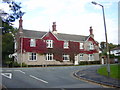
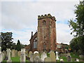
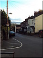
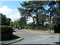
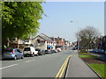
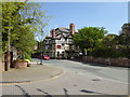
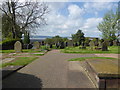
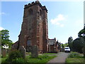
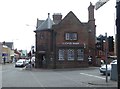
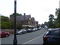
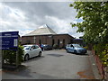
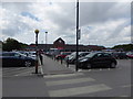
52 photos from this area
Area Information
Key information about the CH60 7SG including its size, population, and administrative classification.
- Area Type
- Postcode
- Area Size
- 8109 m²
- Population
- 1526
- Population Density
- 1921 people/km²
House Prices in CH60 7SG
12
Properties
-
Average Sold Price
-
Lowest Price
-
Highest Price
Showing 12 properties
| Address | Type | Beds | Baths | Last Sale Price | Last Sale Date | |
|---|---|---|---|---|---|---|
| Northcroft, 282-284 Telegraph Road, Heswall, CH60 7SG | house | 5 | 2 | - | - | |
| 250A Telegraph Road, Heswall, CH60 7SG | Flat | 5 | 2 | - | - | |
| Avanti, 250 Telegraph Road, Heswall, CH60 7SG | restaurant_cafe | - | - | - | - | |
| Diamond Design Studio, 240A Telegraph Road, Heswall, CH60 7SG | office_workshop | - | - | - | - | |
| Eye 2 Eye, Eye 2 Eye Opticians, 240 Telegraph Road, Heswall, CH60 7SG | commercial | - | - | - | - | |
| 254A Telegraph Road, Heswall, CH60 7SG | Maisonette | - | - | - | - | |
| The Flat, 248 Telegraph Road, Heswall, CH60 7SG | Flat | - | - | - | - | |
| 252A Telegraph Road, Heswall, CH60 7SG | Flat | - | - | - | - | |
| 256A Telegraph Road, Heswall, CH60 7SG | Maisonette | - | - | - | - | |
| Heswall Centre, 262 Telegraph Road, Heswall, CH60 7SG | community_day_centre | - | - | - | - |
Page 1 of 2
Energy Efficiency in CH60 7SG
Amenities
Schools
| Rank | School | Type | Entry gender | Ages |
|---|
Explore more schools in this area
Go to Schools tabDemographics
Household Size
One person
most common
Accommodation Type
Houses
most common
Tenure
75
majority
Ethnic Group
White
most common
Religion
N/A
most common
Household Composition
N/A
most common
Age
47
median
Adults (30-64 years)
most common
Household Deprivation
N/A
with no deprivation
NS-SEC
49
in Lower managerial occupations
Explore more demographic insights in this area
Go to Demographics tabPlanning
Planning Constraints
- Flood RiskPremium
- Ramsar Wetland SitesPremium
- Area of Outstanding Natural BeautyPremium
- Protected Nature ReservePremium
- Protected WoodlandPremium