Area Overview for CH60 4RS
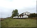
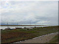
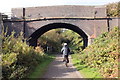
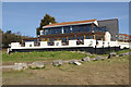
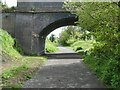
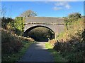
Photos of CH60 4RS

Area Information
Living in CH60 4RS means being part of a small, tightly knit residential cluster in the Wirral Peninsula, where history and modern convenience coexist. The area spans 9,392 square metres and is home to 1,454 residents, creating a moderate population density of 475 people per square kilometre. Nestled in Heswall, a town with roots in the Domesday Book, this postcode area reflects a balance between historic charm and practical living. The upper village buzzes with retail and dining options, while the lower village retains a quieter, older character, preserved as a conservation area since 1979. Daily life here is shaped by proximity to St Peter’s Parish Church, Heswall Primary School, and the nearby Heswall Dales, a rare lowland heath designated for public enjoyment. With rail links to Liverpool and a strong sense of community, CH60 4RS offers a blend of suburban comfort and access to regional opportunities. Its compact size ensures a close-knit environment, where residents are likely to know their neighbours and benefit from the area’s low crime rates and stable housing market.
- Area Type
- Postcode
- Area Size
- 9392 m²
- Population
- 1454
- Population Density
- 475 people/km²
The property market in CH60 4RS is dominated by owner-occupied homes, with 96% of properties owned by residents rather than rented. The accommodation type is exclusively houses, reflecting a traditional suburban layout typical of Heswall. This suggests a market focused on family homes rather than apartments or flats, which may appeal to buyers seeking larger living spaces and long-term stability. The small area size (9,392 m²) and modest population (1,454 residents) indicate a limited housing stock, likely centred on historic properties and newer developments within the conservation area. Buyers should consider the potential for property value appreciation, given the area’s low crime rates and proximity to amenities like schools and retail. However, the limited size of the postcode area may mean competition for available homes, particularly for those seeking properties with unique architectural features, such as 19th-century merchant homes.
House Prices in CH60 4RS
Showing 6 properties
| Address | Type | Beds | Baths | Last Sale Price | Last Sale Date | |
|---|---|---|---|---|---|---|
| 44 Delavor Road, Heswall, CH60 4RS | Bungalow | 3 | 1 | £558,500 | Dec 2024 | |
| 38 Delavor Road, Heswall, CH60 4RS | Bungalow | - | - | £878,000 | Sep 2024 | |
| 36 Delavor Road, Heswall, CH60 4RS | Bungalow | - | - | £350,000 | Jun 2024 | |
| Pipers Cottage, 42 Delavor Road, Heswall, CH60 4RS | Detached | 7 | 3 | £857,500 | Aug 2018 | |
| 48 Delavor Road, Heswall, CH60 4RS | house | - | - | £488,500 | Apr 2017 | |
| Wynyards, 46 Delavor Road, Heswall, CH60 4RS | Detached | 3 | - | £315,000 | May 2013 |
Energy Efficiency in CH60 4RS
Residents of CH60 4RS enjoy a lifestyle that blends suburban convenience with historic charm. The upper village offers five retail options, including Tesco Wirral and Cook Heswall, while the lower village retains a quieter, older character with its conservation area status. Nearby, Heswall Primary School provides a local education hub, and the surrounding Barnston fields offer recreational spaces. The Heswall Dales, a rare lowland heath, is a notable natural feature, designated for public enjoyment. For dining, the area has a variety of restaurants and takeaways, reflecting the upper village’s bustling character. The presence of St Peter’s Parish Church, with its 15th-century tower, adds to the area’s historical appeal. Overall, daily life in CH60 4RS balances practicality with the preservation of Heswall’s distinct identity, offering both modern amenities and access to natural and cultural landmarks.
Amenities
Schools
| Rank | School | Type | Entry gender | Ages |
|---|
Explore more schools in this area
Go to Schools tabDemographics
The community in CH60 4RS is predominantly composed of adults aged 30–64, with a median age of 47, reflecting a mature, established population. Home ownership is exceptionally high at 96%, indicating a strong preference for long-term residency over rental living. The area is characterised by houses rather than flats, aligning with the traditional suburban layout of Heswall. The predominant ethnic group is White, though specific data on diversity is not provided. The population density of 475 people per square kilometre suggests a balanced mix of private homes and communal spaces. This demographic profile implies a stable, family-oriented environment where residents are likely to have established careers and local ties. The high home ownership rate also suggests limited rental availability, which could influence property values and the types of buyers drawn to the area.
Household Size
Accommodation Type
Tenure
Ethnic Group
Religion
Household Composition
Age
Household Deprivation
NS-SEC
Explore more demographic insights in this area
Go to Demographics tabPlanning
Planning Constraints
- Flood RiskPremium
- Ramsar Wetland SitesPremium
- Area of Outstanding Natural BeautyPremium
- Protected Nature ReservePremium
- Protected WoodlandPremium