Area Overview for CH49 5PE
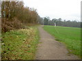
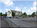
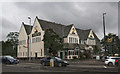
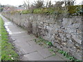
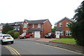
Photos of CH49 5PE


Area Information
Living in CH49 5PE means inhabiting a tightly knit residential cluster on the Wirral Peninsula, where the Dee Estuary meets the Mersey. This small postcode area, covering just 5.9 hectares, is part of Pensby and Thingwall Ward, a historic district with roots in Cheshire’s rural past. Its population of 1,092 is concentrated in a densely populated 18,387 people per square kilometre, reflecting a compact, community-oriented layout. The area’s proximity to Heswall and Birkenhead offers easy access to nearby towns, while its location on the Wirral Peninsula situates it between two major waterways. Daily life here is shaped by its proximity to transport networks and local amenities, though the small size of the area means residents often look to nearby villages for broader services. The postcode’s history as part of Wirral’s reorganisation in 1974 underscores its role in the region’s evolving administrative boundaries. For those seeking a quiet, closely connected community, CH49 5PE offers a snapshot of suburban life with a distinct local character.
- Area Type
- Postcode
- Area Size
- 5.9 hectares
- Population
- Not available
- Population Density
- Not available
The property market in CH49 5PE is characterised by high home ownership (75%) and a focus on houses, which dominate the housing stock. This suggests a market skewed towards owner-occupied properties, with limited rental activity. The small area size (5.9 hectares) means the number of homes is constrained, potentially creating a competitive local market. Buyers should consider the limited scope for expansion within the postcode itself, with nearby areas offering broader options. The prevalence of houses may appeal to those seeking larger living spaces or families, though the compact nature of the area means proximity to amenities and transport is critical. For those prioritising property value stability, the high ownership rate indicates a community with long-term residency, which can be a positive indicator. However, the small size of the area means buyers must evaluate the surrounding regions for additional housing opportunities.
House Prices in CH49 5PE
Showing 28 properties
Energy Efficiency in CH49 5PE
Residents of CH49 5PE have access to a range of practical amenities within walking or short driving distance. The area’s five retail outlets, including Co-op Hoole, Sainsburys Upton, and Asda Arrowe, provide essential shopping options. Three railway stations—Upton, Leasowe, and Moreton—offer easy access to nearby towns and cities, while ferry terminals at Birkenhead, Woodside, and Seacombe connect to Liverpool and beyond. These transport links enhance the area’s appeal for commuters and those seeking proximity to major hubs. The compact nature of the postcode means daily life is centred on local services, though residents may need to venture slightly further for more specialised amenities. The presence of multiple retail and transport options ensures convenience, supporting a lifestyle that balances local convenience with regional connectivity.
Amenities
Schools
| Rank | School | Type | Entry gender | Ages |
|---|
Explore more schools in this area
Go to Schools tabDemographics
CH49 5PE has a median age of 47, with the majority of residents aged 30–64, indicating a mature, stable population. Home ownership is high at 75%, suggesting a strong presence of long-term residents and a focus on family homes. The area’s predominant accommodation type is houses, reflecting a preference for single-family dwellings over flats. The predominant ethnic group is White, with no specific data on other demographics. The population density of 18,387 per square kilometre highlights a tightly packed community, where proximity to neighbours is a defining feature. This density may influence local dynamics, fostering a sense of familiarity but also requiring efficient use of limited space. The absence of detailed diversity metrics means the community profile remains largely defined by its age and ownership patterns, with no explicit mention of socioeconomic deprivation or other factors.
Household Size
Accommodation Type
Tenure
Ethnic Group
Religion
Household Composition
Age
Household Deprivation
NS-SEC
Explore more demographic insights in this area
Go to Demographics tabPlanning
Planning Constraints
- Flood RiskPremium
- Ramsar Wetland SitesPremium
- Area of Outstanding Natural BeautyPremium
- Protected Nature ReservePremium
- Protected WoodlandPremium