Area Overview for CH49 3NS
Photos of CH49 3NS

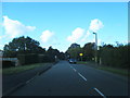
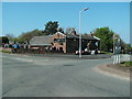
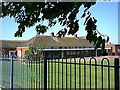
29 photos from this area
Area Information
Key information about the CH49 3NS including its size, population, and administrative classification.
- Area Type
- Postcode
- Area Size
- 6220 m²
- Population
- 1320
- Population Density
- 557 people/km²
House Prices in CH49 3NS
8
Properties
£235,250
Average Sold Price
£84,000
Lowest Price
£387,500
Highest Price
Showing 8 properties
| Address | Type | Beds | Baths | Last Sale Price | Last Sale Date | |
|---|---|---|---|---|---|---|
| 81 Mill Lane, Greasby, CH49 3NS | house | - | - | £387,500 | Dec 2021 | |
| 75 Mill Lane, Greasby, CH49 3NS | Bungalow | - | - | £335,000 | Aug 2020 | |
| 83 Mill Lane, Greasby, CH49 3NS | Detached | 3 | 2 | £270,000 | Apr 2019 | |
| 85 Mill Lane, Greasby, CH49 3NS | Detached | 3 | 1 | £215,000 | Aug 2018 | |
| 89 Mill Lane, Greasby, CH49 3NS | Detached | - | - | £84,000 | May 1999 | |
| 77 Mill Lane, Greasby, CH49 3NS | Detached | - | - | £120,000 | Jan 1998 | |
| 79 Mill Lane, Greasby, CH49 3NS | Detached | - | - | - | - | |
| 87 Mill Lane, Greasby, CH49 3NS | house | - | - | - | - |
Energy Efficiency in CH49 3NS
Amenities
Schools
| Rank | School | Type | Entry gender | Ages |
|---|
Explore more schools in this area
Go to Schools tabDemographics
Household Size
Two person
most common
Accommodation Type
Houses
most common
Tenure
91
majority
Ethnic Group
White
most common
Religion
N/A
most common
Household Composition
N/A
most common
Age
47
median
Elderly (65+ years)
most common
Household Deprivation
N/A
with no deprivation
NS-SEC
44
in Lower managerial occupations
Explore more demographic insights in this area
Go to Demographics tabPlanning
Planning Constraints
- Flood RiskPremium
- Ramsar Wetland SitesPremium
- Area of Outstanding Natural BeautyPremium
- Protected Nature ReservePremium
- Protected WoodlandPremium