Area Overview for CH49 2PS
Photos of CH49 2PS
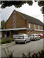
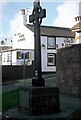
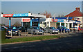
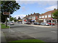
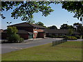

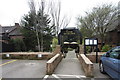
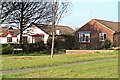
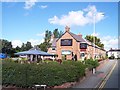
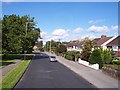
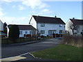
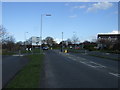
37 photos from this area
Area Information
Key information about the CH49 2PS including its size, population, and administrative classification.
- Area Type
- Postcode
- Area Size
- 2.5 hectares
- Population
- 1414
- Population Density
- 4555 people/km²
House Prices in CH49 2PS
31
Properties
£235,115
Average Sold Price
£72,000
Lowest Price
£430,000
Highest Price
Showing 31 properties
| Address | Type | Beds | Baths | Last Sale Price | Last Sale Date | |
|---|---|---|---|---|---|---|
| 18 Rylands Hey, Greasby, CH49 2PS | Bungalow | - | - | £430,000 | Jul 2024 | |
| 1 Rylands Hey, Greasby, CH49 2PS | Bungalow | - | - | £290,000 | Jul 2018 | |
| 19 Rylands Hey, Greasby, CH49 2PS | house | - | - | £223,000 | Apr 2018 | |
| 21 Rylands Hey, Greasby, CH49 2PS | Semi-detached | 3 | - | £195,500 | Jul 2015 | |
| 5 Rylands Hey, Greasby, CH49 2PS | Bungalow | 2 | - | £205,000 | Jan 2014 | |
| 35 Rylands Hey, Greasby, CH49 2PS | Bungalow | 4 | - | £249,999 | May 2012 | |
| 7 Rylands Hey, Greasby, CH49 2PS | Bungalow | - | - | £205,000 | May 2009 | |
| 24 Rylands Hey, Greasby, CH49 2PS | Detached | - | - | £245,000 | Sep 2008 | |
| 4 Rylands Hey, Greasby, CH49 2PS | Detached | - | - | £220,000 | Nov 2007 | |
| 3D Rylands Hey, Greasby, CH49 2PS | house | - | - | £273,000 | Oct 2005 |
Page 1 of 4
Energy Efficiency in CH49 2PS
Amenities
Schools
| Rank | School | Type | Entry gender | Ages |
|---|
Explore more schools in this area
Go to Schools tabDemographics
Household Size
Two person
most common
Accommodation Type
Houses
most common
Tenure
79
majority
Ethnic Group
White
most common
Religion
N/A
most common
Household Composition
N/A
most common
Age
47
median
Adults (30-64 years)
most common
Household Deprivation
N/A
with no deprivation
NS-SEC
41
in Lower managerial occupations
Explore more demographic insights in this area
Go to Demographics tabPlanning
Planning Constraints
- Flood RiskPremium
- Ramsar Wetland SitesPremium
- Area of Outstanding Natural BeautyPremium
- Protected Nature ReservePremium
- Protected WoodlandPremium