Area Overview for CH49 1RH
Photos of CH49 1RH
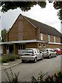
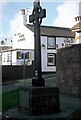
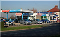
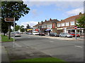
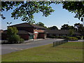

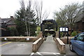
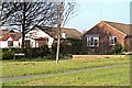
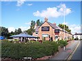
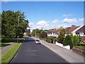
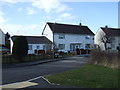
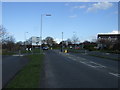
37 photos from this area
Area Information
Key information about the CH49 1RH including its size, population, and administrative classification.
- Area Type
- Postcode
- Area Size
- 8179 m²
- Population
- 1190
- Population Density
- 4001 people/km²
House Prices in CH49 1RH
23
Properties
£185,036
Average Sold Price
£58,000
Lowest Price
£345,000
Highest Price
Showing 23 properties
| Address | Type | Beds | Baths | Last Sale Price | Last Sale Date | |
|---|---|---|---|---|---|---|
| 77 Lloyd Drive, Greasby, CH49 1RH | Semi-detached | 3 | 1 | £336,000 | Mar 2025 | |
| 79 Lloyd Drive, Greasby, CH49 1RH | Semi-detached | 3 | 1 | £345,000 | Feb 2025 | |
| 97 Lloyd Drive, Greasby, CH49 1RH | house | - | - | £305,000 | Oct 2022 | |
| 103 Lloyd Drive, Greasby, CH49 1RH | Detached | 3 | 1 | £252,000 | Nov 2020 | |
| 93 Lloyd Drive, Greasby, CH49 1RH | Detached | 3 | 1 | £185,000 | Oct 2020 | |
| 75 Lloyd Drive, Greasby, CH49 1RH | house | - | - | £150,000 | Sep 2016 | |
| 63 Lloyd Drive, Greasby, CH49 1RH | house | - | - | £170,500 | Aug 2013 | |
| 87 Lloyd Drive, Greasby, CH49 1RH | house | - | - | £227,000 | Sep 2012 | |
| 69 Lloyd Drive, Greasby, CH49 1RH | house | - | - | £145,500 | Nov 2009 | |
| 85 Lloyd Drive, Greasby, CH49 1RH | house | - | - | £149,000 | May 2004 |
Page 1 of 3
Energy Efficiency in CH49 1RH
Amenities
Schools
| Rank | School | Type | Entry gender | Ages |
|---|
Explore more schools in this area
Go to Schools tabDemographics
Household Size
Two person
most common
Accommodation Type
Houses
most common
Tenure
95
majority
Ethnic Group
White
most common
Religion
N/A
most common
Household Composition
N/A
most common
Age
47
median
Adults (30-64 years)
most common
Household Deprivation
N/A
with no deprivation
NS-SEC
42
in Lower managerial occupations
Explore more demographic insights in this area
Go to Demographics tabPlanning
Planning Constraints
- Flood RiskPremium
- Ramsar Wetland SitesPremium
- Area of Outstanding Natural BeautyPremium
- Protected Nature ReservePremium
- Protected WoodlandPremium