Area Overview for CH48 7EW
Photos of CH48 7EW

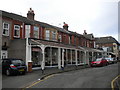
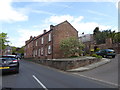

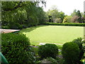
100 photos from this area
Area Information
Key information about the CH48 7EW including its size, population, and administrative classification.
- Area Type
- Postcode
- Area Size
- 1.9 hectares
- Population
- 1637
- Population Density
- 2799 people/km²
House Prices in CH48 7EW
12
Properties
£684,563
Average Sold Price
£175,000
Lowest Price
£1,336,500
Highest Price
Showing 12 properties
| Address | Type | Beds | Baths | Last Sale Price | Last Sale Date | |
|---|---|---|---|---|---|---|
| 18 Abbey Road, West Kirby, CH48 7EW | house | - | - | £1,336,500 | Sep 2023 | |
| Waverley, 22 Abbey Road, West Kirby, CH48 7EW | house | - | - | £850,000 | Mar 2022 | |
| 4 Abbey Road, West Kirby, CH48 7EW | Detached | 4 | 2 | £895,000 | Mar 2021 | |
| St Evroul, 20 Abbey Road, West Kirby, CH48 7EW | house | - | - | £795,000 | Oct 2017 | |
| 16 Abbey Road, West Kirby, CH48 7EW | Detached | 6 | 2 | £700,000 | Jan 2017 | |
| Deya, 14 Abbey Road, West Kirby, CH48 7EW | house | - | - | £500,000 | May 2014 | |
| 12 Abbey Road, West Kirby, CH48 7EW | Detached | - | - | £175,000 | Apr 1998 | |
| Hillcrest House, 6 Abbey Road, West Kirby, CH48 7EW | Detached | - | - | £225,000 | Feb 1998 | |
| 10 Abbey Road, West Kirby, CH48 7EW | house | - | - | - | - | |
| 2 Abbey Road, West Kirby, CH48 7EW | Flat | - | - | - | - |
Page 1 of 2
Energy Efficiency in CH48 7EW
Amenities
Schools
| Rank | School | Type | Entry gender | Ages |
|---|
Explore more schools in this area
Go to Schools tabDemographics
Household Size
Two person
most common
Accommodation Type
Houses
most common
Tenure
88
majority
Ethnic Group
White
most common
Religion
N/A
most common
Household Composition
N/A
most common
Age
47
median
Adults (30-64 years)
most common
Household Deprivation
N/A
with no deprivation
NS-SEC
53
in Lower managerial occupations
Explore more demographic insights in this area
Go to Demographics tabPlanning
Planning Constraints
- Flood RiskPremium
- Ramsar Wetland SitesPremium
- Area of Outstanding Natural BeautyPremium
- Protected Nature ReservePremium
- Protected WoodlandPremium