Area Overview for CH48 6DQ
Photos of CH48 6DQ
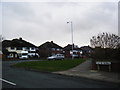
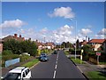
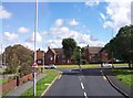
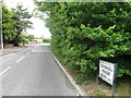
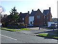
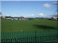
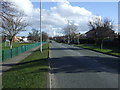
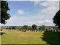
18 photos from this area
Area Information
Key information about the CH48 6DQ including its size, population, and administrative classification.
- Area Type
- Postcode
- Area Size
- 1.1 hectares
- Population
- 1446
- Population Density
- 1248 people/km²
House Prices in CH48 6DQ
32
Properties
£146,598
Average Sold Price
£16,720
Lowest Price
£235,000
Highest Price
Showing 32 properties
| Address | Type | Beds | Baths | Last Sale Price | Last Sale Date | |
|---|---|---|---|---|---|---|
| 62 Gilroy Road, Newton, CH48 6DQ | house | - | - | £225,000 | Jan 2024 | |
| 36 Gilroy Road, Newton, CH48 6DQ | Terraced | 3 | 1 | £235,000 | May 2023 | |
| 28 Gilroy Road, Newton, CH48 6DQ | house | - | - | £185,000 | Jan 2023 | |
| 32 Gilroy Road, Newton, CH48 6DQ | house | - | - | £215,000 | Oct 2022 | |
| 10 Gilroy Road, Newton, CH48 6DQ | house | - | - | £189,000 | Oct 2021 | |
| 30 Gilroy Road, Newton, CH48 6DQ | Terraced | 3 | 1 | £175,000 | Jul 2021 | |
| 18 Gilroy Road, Newton, CH48 6DQ | Semi-detached | 3 | 1 | £148,000 | Jun 2017 | |
| 64 Gilroy Road, Newton, CH48 6DQ | Semi-detached | - | - | £166,000 | May 2016 | |
| 56 Gilroy Road, Newton, CH48 6DQ | house | - | - | £142,000 | Jun 2015 | |
| 38 Gilroy Road, Newton, CH48 6DQ | Semi-detached | 3 | - | £152,950 | Nov 2014 |
Page 1 of 4
Energy Efficiency in CH48 6DQ
Amenities
Schools
| Rank | School | Type | Entry gender | Ages |
|---|
Explore more schools in this area
Go to Schools tabDemographics
Household Size
Family (3-5 people)
most common
Accommodation Type
Houses
most common
Tenure
59
majority
Ethnic Group
White
most common
Religion
N/A
most common
Household Composition
N/A
most common
Age
47
median
Adults (30-64 years)
most common
Household Deprivation
N/A
with no deprivation
NS-SEC
27
in Lower managerial occupations
Explore more demographic insights in this area
Go to Demographics tabPlanning
Planning Constraints
- Flood RiskPremium
- Ramsar Wetland SitesPremium
- Area of Outstanding Natural BeautyPremium
- Protected Nature ReservePremium
- Protected WoodlandPremium