Area Overview for CH48 5HY
Photos of CH48 5HY
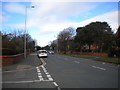
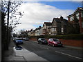
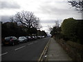
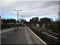

35 photos from this area
Area Information
Key information about the CH48 5HY including its size, population, and administrative classification.
- Area Type
- Postcode
- Area Size
- 6451 m²
- Population
- 1637
- Population Density
- 2799 people/km²
House Prices in CH48 5HY
18
Properties
£181,086
Average Sold Price
£58,500
Lowest Price
£332,780
Highest Price
Showing 18 properties
| Address | Type | Beds | Baths | Last Sale Price | Last Sale Date | |
|---|---|---|---|---|---|---|
| 7 Boulton Avenue, West Kirby, CH48 5HY | Semi-detached | 3 | 1 | £332,780 | Mar 2025 | |
| 17 Boulton Avenue, West Kirby, CH48 5HY | Semi-detached | 3 | 1 | £244,000 | Sep 2024 | |
| 35 Boulton Avenue, West Kirby, CH48 5HY | house | - | - | £250,000 | Sep 2021 | |
| 1 Boulton Avenue, West Kirby, CH48 5HY | Semi-detached | 3 | 1 | £270,000 | Dec 2020 | |
| 33 Boulton Avenue, West Kirby, CH48 5HY | house | - | - | £175,000 | Feb 2019 | |
| 3 Boulton Avenue, West Kirby, CH48 5HY | Semi-detached | 3 | 1 | £173,250 | Oct 2017 | |
| 21 Boulton Avenue, West Kirby, CH48 5HY | house | - | - | £152,500 | Aug 2014 | |
| 5 Boulton Avenue, West Kirby, CH48 5HY | Semi-detached | 3 | - | £145,000 | Feb 2014 | |
| 27 Boulton Avenue, West Kirby, CH48 5HY | house | - | - | £142,500 | Jul 2013 | |
| 19 Boulton Avenue, West Kirby, CH48 5HY | house | - | - | £155,000 | May 2007 |
Page 1 of 2
Energy Efficiency in CH48 5HY
Amenities
Schools
| Rank | School | Type | Entry gender | Ages |
|---|
Explore more schools in this area
Go to Schools tabDemographics
Household Size
Two person
most common
Accommodation Type
Houses
most common
Tenure
88
majority
Ethnic Group
White
most common
Religion
N/A
most common
Household Composition
N/A
most common
Age
47
median
Adults (30-64 years)
most common
Household Deprivation
N/A
with no deprivation
NS-SEC
53
in Lower managerial occupations
Explore more demographic insights in this area
Go to Demographics tabPlanning
Planning Constraints
- Flood RiskPremium
- Ramsar Wetland SitesPremium
- Area of Outstanding Natural BeautyPremium
- Protected Nature ReservePremium
- Protected WoodlandPremium