Area Overview for CH48 2JJ
Photos of CH48 2JJ
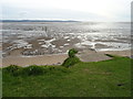
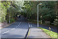
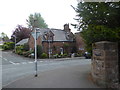
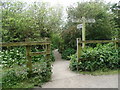
55 photos from this area
Area Information
Key information about the CH48 2JJ including its size, population, and administrative classification.
- Area Type
- Postcode
- Area Size
- 10.3 hectares
- Population
- 1229
- Population Density
- 425 people/km²
House Prices in CH48 2JJ
12
Properties
£1,616,875
Average Sold Price
£800,000
Lowest Price
£2,900,000
Highest Price
Showing 12 properties
| Address | Type | Beds | Baths | Last Sale Price | Last Sale Date | |
|---|---|---|---|---|---|---|
| Rock Mount, Thorsway, Caldy, CH48 2JJ | Detached | 6 | 3 | £2,900,000 | Jul 2024 | |
| Axiothea, Thorsway, Caldy, CH48 2JJ | house | - | - | £1,000,000 | Nov 2021 | |
| Brean Down, Thorsway, Caldy, CH48 2JJ | Detached | 5 | - | £1,800,000 | Sep 2021 | |
| The Summit, Thorsway, Caldy, CH48 2JJ | Detached | 6 | 4 | £1,200,000 | May 2021 | |
| Eden Roc, Thorsway, Caldy, CH48 2JJ | Detached | 5 | - | £2,000,000 | May 2021 | |
| Hill House, Thorsway, Caldy, CH48 2JJ | Detached | 4 | 3 | £800,000 | Apr 2021 | |
| Grindley Brook, Thorsway, Caldy, CH48 2JJ | Detached | 5 | - | £900,000 | Apr 2017 | |
| The Four Winds, Thorsway, Caldy, CH48 2JJ | Detached | 6 | 9 | £2,335,000 | Jun 2008 | |
| Mara, 1 Thorsway, Caldy, CH48 2JJ | Detached | 5 | 4 | - | - | |
| West Ridge, Thorsway, Caldy, CH48 2JJ | Detached | - | - | - | - |
Page 1 of 2
Energy Efficiency in CH48 2JJ
Amenities
Schools
| Rank | School | Type | Entry gender | Ages |
|---|
Explore more schools in this area
Go to Schools tabDemographics
Household Size
Two person
most common
Accommodation Type
Houses
most common
Tenure
95
majority
Ethnic Group
White
most common
Religion
N/A
most common
Household Composition
N/A
most common
Age
47
median
Adults (30-64 years)
most common
Household Deprivation
N/A
with no deprivation
NS-SEC
54
in Lower managerial occupations
Explore more demographic insights in this area
Go to Demographics tabPlanning
Planning Constraints
- Flood RiskPremium
- Ramsar Wetland SitesPremium
- Area of Outstanding Natural BeautyPremium
- Protected Nature ReservePremium
- Protected WoodlandPremium