Area Overview for CH47 4AW
Photos of CH47 4AW
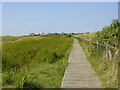
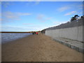


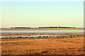

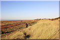

35 photos from this area
Area Information
Key information about the CH47 4AW including its size, population, and administrative classification.
- Area Type
- Postcode
- Area Size
- 14.0 hectares
- Population
- 1586
- Population Density
- 818 people/km²
House Prices in CH47 4AW
16
Properties
£619,128
Average Sold Price
£135,000
Lowest Price
£965,000
Highest Price
Showing 16 properties
| Address | Type | Beds | Baths | Last Sale Price | Last Sale Date | |
|---|---|---|---|---|---|---|
| Chevrons, 72 Meols Drive, West Kirby, CH47 4AW | house | - | - | £665,000 | Jul 2024 | |
| Hatherleigh, 64 Meols Drive, West Kirby, CH47 4AW | Semi-detached | 5 | 2 | £745,000 | Jan 2020 | |
| White Knowle, 67 Meols Drive, West Kirby, CH47 4AW | Detached | 6 | 2 | £762,500 | Jun 2019 | |
| Dowie House, 78A Meols Drive, West Kirby, CH47 4AW | house | - | - | £787,900 | Aug 2018 | |
| Hollybank, 74A Meols Drive, West Kirby, CH47 4AW | Detached | 5 | - | £820,000 | Mar 2017 | |
| Mulbarton, 60 Meols Drive, West Kirby, CH47 4AW | Detached | 5 | - | £965,000 | Apr 2006 | |
| Melness, 66 Meols Drive, West Kirby, CH47 4AW | Semi-detached | - | - | £476,750 | Jul 2005 | |
| Royd Cottage, 70 Meols Drive, West Kirby, CH47 4AW | house | - | - | £215,000 | Dec 1998 | |
| St Hilary, 74 Meols Drive, West Kirby, CH47 4AW | Semi-detached | - | - | £135,000 | Sep 1997 | |
| 76A Meols Drive, West Kirby, CH47 4AW | Detached | 6 | - | - | - |
Page 1 of 2
Energy Efficiency in CH47 4AW
Amenities
Schools
| Rank | School | Type | Entry gender | Ages |
|---|
Explore more schools in this area
Go to Schools tabDemographics
Household Size
One person
most common
Accommodation Type
Houses
most common
Tenure
71
majority
Ethnic Group
White
most common
Religion
N/A
most common
Household Composition
N/A
most common
Age
47
median
Adults (30-64 years)
most common
Household Deprivation
N/A
with no deprivation
NS-SEC
44
in Lower managerial occupations
Explore more demographic insights in this area
Go to Demographics tabPlanning
Planning Constraints
- Flood RiskPremium
- Ramsar Wetland SitesPremium
- Area of Outstanding Natural BeautyPremium
- Protected Nature ReservePremium
- Protected WoodlandPremium