Area Overview for CH47 4AL
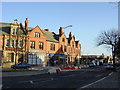
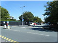
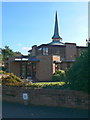
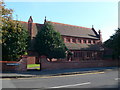
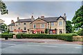
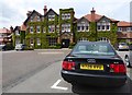
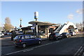
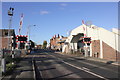
Photos of CH47 4AL
Area Information
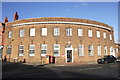
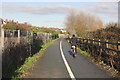
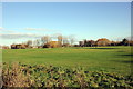
CH47 4AL is a small, tightly packed residential cluster in the coastal suburb of Hoylake, part of Wirral in Merseyside. Covering just 2.1 hectares, it is home to 1,586 residents, making it a densely populated yet compact area. The postcode sits on the Wirral Peninsula, historically part of Cheshire but now within Merseyside since 1974. Its roots trace back to Viking settlements, with Meols named from Old Norse for "sand-hills," and 19th-century development around Hoyle Lake, a historic anchorage. Today, it balances suburban comfort with coastal charm, offering proximity to the sea, historic sites like the Royal Liverpool Golf Club, and the Hoylake promenade. Daily life here is shaped by its proximity to rail networks, retail hubs, and a mix of schools. With a population density of 818 people per square kilometre, the area feels lived-in and community-focused, ideal for those seeking a settled, family-oriented environment near amenities.
- Area Type
- Postcode
- Area Size
- 2.1 hectares
- Population
- 1586
- Population Density
- 818 people/km²
CH47 4AL is primarily an owner-occupied area, with 71% of homes owned by residents rather than rented. The accommodation type is predominantly houses, which is typical of suburban areas with a focus on family living. This suggests a housing stock that prioritises space and privacy, making it suitable for those seeking larger properties. Given the small area size of 2.1 hectares and the high population density, the housing stock is likely limited, with properties concentrated in a compact footprint. Buyers should consider the proximity to schools, transport links, and coastal amenities when evaluating the area. The emphasis on owner-occupation also implies a stable market, with fewer rental properties available, which may appeal to those looking for long-term investment or a place to settle.
House Prices in CH47 4AL
Showing 1 properties
| Address | Type | Beds | Baths | Last Sale Price | Last Sale Date | |
|---|---|---|---|---|---|---|
| Residence, Royal Liverpool Golf Club, 30 Meols Drive, Hoylake, CH47 4AL | Detached | - | - | - | - |
Energy Efficiency in CH47 4AL
Residents of CH47 4AL enjoy a mix of practical amenities and historical charm. The area’s rail stations provide easy access to nearby towns, while local retail outlets like Sainsburys and Co-op cater to daily needs. The coastal location offers proximity to the Hoylake promenade, a historic site built in the late 19th century, and the Royal Liverpool Golf Club, which has been a landmark since 1895. The presence of lighthouses, such as Hoylake Upper Lighthouse, adds to the area’s character. While the amenities are not extensive, they are well-suited to a suburban lifestyle, offering convenience without the bustle of larger urban centres. The blend of historical sites and modern infrastructure creates a balanced environment for families and professionals.
Amenities
Schools
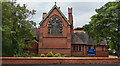
Residents of CH47 4AL have access to a range of schools, including West Kirby Primary School, which holds a "good" Ofsted rating, and West Kirby Grammar School, which operates as both a primary school and an academy with a "good" rating. Dormie House School, an independent institution, offers an alternative for families seeking private education. West Kirby School and College caters to special educational needs. The mix of state and independent schools provides flexibility for parents, whether they prioritise local public education or seek the resources of a private institution. The presence of a "good" Ofsted-rated primary school suggests a solid foundation for early education, while the variety of school types ensures options for different educational preferences and requirements.
| Rank | School | Type | Entry gender | Ages |
|---|
Explore more schools in this area
Go to Schools tabDemographics
The population of CH47 4AL has a median age of 47, with the majority of residents aged between 30 and 64. This suggests a mature, stable community, likely with established families and professionals. Home ownership is high, at 71%, indicating a strong presence of long-term residents. The area is predominantly composed of houses, reflecting a more traditional, family-oriented housing stock. The predominant ethnic group is White, though specific data on diversity is not provided. The high population density of 818 people per square kilometre, combined with the compact size of the area, suggests a tightly knit community where social interactions are frequent. This demographic profile points to a low turnover of residents and a focus on long-term living, which can be appealing to those seeking a stable, familiar environment.
Household Size
Accommodation Type
Tenure
Ethnic Group
Religion
Household Composition
Age
Household Deprivation
NS-SEC
Explore more demographic insights in this area
Go to Demographics tabPlanning
Planning Constraints
- Flood RiskPremium
- Ramsar Wetland SitesPremium
- Area of Outstanding Natural BeautyPremium
- Protected Nature ReservePremium
- Protected WoodlandPremium