Area Overview for CH47 3WE
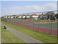
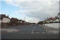
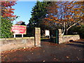
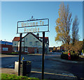
Photos of CH47 3WE

Area Information
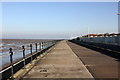
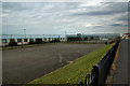
Living in CH47 3WE means inhabiting a small, densely populated residential cluster in the Wirral Peninsula. With a population of 1,375 and a density of 963 people per square kilometre, this postcode area reflects a compact, coastal suburban character. Situated in Hoylake and Meols, it sits on the edge of the Mersey, historically part of Cheshire before becoming part of Merseyside in 1974. The area’s roots trace back to Viking settlements and 19th-century fishing village growth, with landmarks like the Royal Liverpool Golf Club and Hoylake Upper Lighthouse adding to its distinctiveness. Daily life here balances proximity to nature with suburban convenience, offering access to rail links, retail hubs, and a mix of historical and modern amenities. The community is defined by its older demographic profile, with a median age of 47, and a focus on owner-occupied homes. For buyers, CH47 3WE presents a compact, well-connected area with a quiet coastal vibe, though its small size means limited housing stock.
- Area Type
- Postcode
- Area Size
- Not available
- Population
- 1375
- Population Density
- 963 people/km²
CH47 3WE is primarily an owner-occupied area, with 59% of homes owned by residents rather than rented. The accommodation type is predominantly houses, which suggests a focus on family homes and single-family living. This contrasts with areas dominated by flats or rental properties, where the market might be more transient. The small size of the postcode area means the housing stock is limited, with buyers likely needing to consider nearby postcodes for additional options. The presence of houses rather than flats indicates a preference for private, standalone properties, which may appeal to those seeking space and security. For buyers, this area offers a stable market with a clear demographic profile, though the limited housing stock could make competition for properties more intense.
House Prices in CH47 3WE
No properties found in this postcode.
Energy Efficiency in CH47 3WE
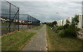
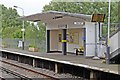
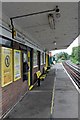
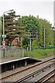
CH47 3WE offers a blend of practical amenities and coastal charm. Within practical reach are five retail outlets, including Co-op Hoylake, Sainsburys Hoylake, and Morrisons Daily, ensuring everyday shopping needs are met. The rail network, with stations like Manor Road and Hoylake, connects residents to nearby towns and cities, enhancing mobility. The area’s proximity to the Wirral Peninsula’s natural features, such as the Mersey coast, provides opportunities for walks, cycling, or leisure activities. The presence of historical sites like the Royal Liverpool Golf Club and Hoylake Upper Lighthouse adds cultural and recreational value. While the area is small, its amenities are concentrated, offering convenience without sacrificing the quiet, suburban feel that defines the Wirral’s coastal suburbs.
Amenities
Schools
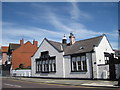
Near CH47 3WE are two schools: Hoylake Holy Trinity CofE Primary School, a state-funded primary school with a good Ofsted rating, and Kingsmead School, an independent secondary institution. The mix of state and independent options provides families with flexibility, whether they seek free education or fee-paying institutions. Hoylake Holy Trinity’s good rating suggests a reliable, well-regarded primary education, while Kingsmead’s independent status may offer specialized curricula or smaller class sizes. The proximity of both schools to the area means parents can access quality education without long commutes. However, the absence of data on secondary state schools means families relying on public education may need to look slightly beyond CH47 3WE for secondary options.
| Rank | School | Type | Entry gender | Ages |
|---|
Explore more schools in this area
Go to Schools tabDemographics
The population of CH47 3WE skews towards adults aged 30–64, with a median age of 47. This suggests a community of established professionals and families, rather than a younger or elderly demographic. Home ownership stands at 59%, indicating a stable, long-term resident base. The area is predominantly composed of houses, not flats, which aligns with the higher proportion of owner-occupied properties. The predominant ethnic group is White, reflecting the broader demographic trends of the Wirral Peninsula. With a population density of 963 people per square kilometre, the area is compact but not overcrowded, allowing for a mix of private and shared spaces. The absence of specific data on deprivation means the quality of life here is likely shaped by the availability of amenities, low crime rates, and proximity to natural features like the Mersey coast.
Household Size
Accommodation Type
Tenure
Ethnic Group
Religion
Household Composition
Age
Household Deprivation
NS-SEC
Explore more demographic insights in this area
Go to Demographics tabPlanning
Planning Constraints
- Flood RiskPremium
- Ramsar Wetland SitesPremium
- Area of Outstanding Natural BeautyPremium
- Protected Nature ReservePremium
- Protected WoodlandPremium